Google Self-Driving Robot Boat Maps SF Shoreline, Extends Street View To Waterways
SAN FRANCISCO (KPIX) -- Google, the company that first brought us 360-degree interactive views of our streets and highways is setting its sights on the water.
Perhaps it should be called Google Shoreview. A vessel outfitted with Google's "Trekker" spherical photo and mapping technology was tied up at San Francisco's Fort Mason marina after spending a day cruising the bay.
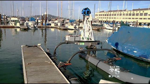
The goal is to capture the entire bay shoreline and make it available online. Eventually you'll be able to virtually navigate hundreds of miles of the bay's coast from the comfort of your internet-connected device.
"I like to fish and I go up around the Marin coast," one man eyeing the strange-looking vessel at Fort Mason told KPIX. "I need to navigate and this will help me."
There's real science involved as well. When complete, the system will help measure Bay Area water-level changes and could help scientists with their study of sensitive bay habitats.
The project is a partnership with the environmental group Baykeeper, which won a $100,000 grant from Google for the survey.