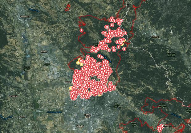
Interactive Cal Fire Map Shows Status Of Structures In Wildfire Zone
SANTA ROSA (CBS SF) – Cal Fire has created an interactive online map in which residents of Sonoma County can look up whether a structure has been damaged or destroyed in the wildfires that continue to burn in the area.
Residents can type in an address or zoom in on a particular part of the map to see whether a structure was destroyed, damaged or unaffected by the wildfires that sparked Oct. 8.
WINE COUNTRY WILDFIRES: Continuing Coverage | How To Help
The map can be accessed at: http://calfire-forestry.maps.arcgis.com/apps/PublicInformation/index.html?appid=5bbcbed430ad45e5a38e6be155ef5fec.
Sonoma County officials are reminding residents of the Local Assistance Center available in Santa Rosa for those with damaged or destroyed property.
The center at the Press Democrat building at 427 Mendocino Ave. in Santa Rosa is open from 9 a.m. to 6 p.m. daily.
© Copyright 2017 by CBS San Francisco and Bay City News Service. All rights reserved. This material may not be published, broadcast, rewritten or redistributed.