New USGS Maps Show Earthquakes, Coastal Erosion Could Be Worse Than Previously Thought
 MONTEREY (KCBS) -- Stormy weather over the past few months has had an impact along the California coast that you can't see from the shore, but scientists taking a close look at some new high resolution maps can, and what they've found is cause for concern.
Sam Johnson, a researcher with the US Geological Survey, told KCBS that there's not a lot of sediment offshore of Manresa and Sunset beaches in Santa Cruz that could be used to combat coastal erosion due to sea level rise.
"Offshore sediment can be a bit of a buffer in combatting coastal erosion," Johnson said.
Johnson said that sediment can be used to replenish, or nourish, beaches that need more sand, and that can happen naturally or through efforts by people. But, the fact that there's so little of it is alarming.
"It is alarming. Again, it's an indication of where there's not sediment available off shore that might naturally move onshore," Johnson said.
Johnson said the maps, which were developed using sonar imaging, also indicate there are more earthquake faults off the coast than previously thought, and that's good information to have.
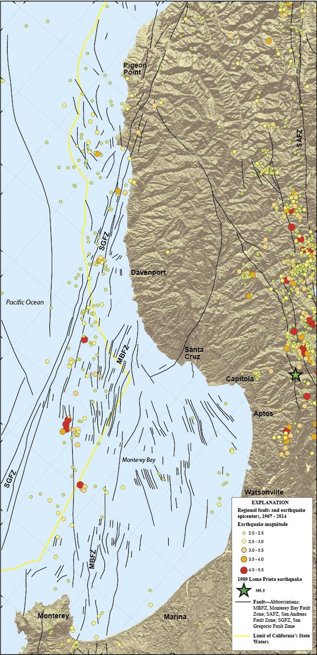
"Earthquakes scale with fault lengths, so the longer the fault, the larger the potential earthquake along that structure," Johnson said.