LNU Lightning Complex: Areas Of Healdsburg, Lake County Among Latest Evacuations Ordered
HEALDSBURG (KPIX) -- New evacuation orders were issued for the Healdsburg area and parts of Sonoma County and Lake County on Saturday as the Walbridge fire, part of the massive LNU Lightning Complex, grew to more than 314,207 acres.
LAKE COUNTY: All residents living south of Morgan Valley Rd., west of the Mandatory Evacuation boarder line at Sky High Ridge Rd. to Highway 29 and Highway 53 in Lower Lake. East of Highway 29 at Hofacker Ln. have been ordered to evacuate immediately.
SONOMA COUNTY
Around 11 a.m., officials announced that areas of Healdsburg west of Highway 101 were to be evacuated. The order covers portions of these streets, including:
Burgundy Road
Chablis Road
Chateau Real
Chiquita Road - only the portion west of 101
Hassett Road (off of Chiquita Road)
Matteri Road
Reisling Lane
Zinfandel Road
Meanwhile, the remainder of the community of Healdsburg remained under an evacuation warning.
Along with portions of Healdsburg, evacuations were called for the following Sonoma County zones: 2F1, 2F2, 2F3, 2K1, 2K2, 4A1 and 4C1.
The evacuations came as the massive and deadly LNU Lightning Complex burned down at least 560 structures claimed four lives and injured another four fire victims.
While Cal Fire officials were reporting 15 percent containment of the massive complex of wildfires, the Walbridge Fire remained at zero containment.
At 314,207 acres, the LNU Lightning Complex -- now the second largest wildfire in California history -- has now grown to the equivalent of more than 472 square miles. In comparison, Manhattan is a mere 22.8 square miles and Chicago is 234.
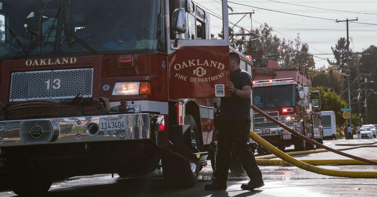
Early Saturday, Cal Fire said the Walbridge Fire was a top priority as it has the potential to roar right into Healdsburg if the winds shift and increase in intensity.
Several homes on Wallace Creek Road went up in flames as the fire ripped through the area. On Friday night, firefighters on the front lines are working tirelessly to put out flames before the wind shifts and directs the blaze toward town.
Flames engulfed the Mill Creek area and left a path of destruction. Those who evacuated are hoping they won't return to devastation.
"That's the tough part. You don't know what's going on," said Blake Rogers, whose parents have a home in the fire zone.
Rogers' parents are wondering if that home is still standing. Crews have been working around the clock trying to knock down the fire building up inside towering redwoods and smoldering in remote areas just west of Healdsburg.
The traditional shift of 24 hours on and 24 hours off doesn't apply to these firefighters.
"On this incident, firefighters are working 72-plus hours straight on the line at 100 degrees plus in some parts of this complex," said Paul Lowenthal, Walbridge Fire public information officer.
Firefighters are desperately trying to get containment as weather forecasts call for winds out of the south this weekend, putting the town of Healdsburg in danger.
"The concern is, once the wind shifts, it's going to challenge that side of the fire," Lowenthal said.
LIGHTNING WILDFIRES
- CZU Complex Fire Update: 5 Suspected Looters Arrested; Firefighters Rescue Trapped Residents; At Least 97 Structures Destroyed
- Threat Of Dry Thunderstorms, Winds Prompt Evacuation Warning For Carmel Valley
- Raining Ash An 'Eerie' Sense Of Deja Vu For Healdsburg Businesses In Shadow Of Wildfires
- East San Jose Residents Dubious of Evacuation Orders
- LNU Lightning Complex Update: Homes Burn Near Healdsburg; 3 Napa Victims Found In Fire-Ravaged Neighborhood
- SCU Lightning Complex: Firefighters Brace For Tough Afternoon Battle; 229,918 Acres Burned, 20,020 Residents Evacuated
- Napa County:OES Info: https://www.countyofnapa.org/353/Emergency-ServicesEvac Info: https://www.countyofnapa.org/CivicAlerts.aspx?AID=182Napa County Information Line: (707) 253-4540Evacuation Order:
- Highway 128 from Lower Chiles Valley Road to Monticello Road
- Highway 128 from Chiles Pope Valley Road to Lower Chiles Valley Road
- Chiles Pope Valley Road from Highway 128 to Lower Chiles Valley Road
- All of Hennessey Ridge Road.
- From Moskowite Corner to Wooden Valley Rd, Including the community of Circle Oaks
- Atlas Peak from the Bubbing Well Pet Cemetary at 2462 Atlas Peak Rd to the dead end
- From Loma Vista Rd / Soda Canyon Rd to the dead end.
- All of Steele Canyon Rd from Hwy 128 to and including the Berryessa Highlands Sub Divison
- Wragg Canyon Rd - from Hwy 128 to the end of the road, including Pleasure Cove Resort
- Chiles Pope Valley Road - From Lower Chiles Valley Road to Pope Canyon Road
- Highway 121 (Monticello Road) – from Wooden Valley Road to Silveraldo Trail
- Pope Valley Road – From Aetna Springs Road to Chiles Pope Valley Road
- Aetna Springs Road – From Pope Valley to the dead end
- Butts Canyon Road – From Aetna Springs Road to the Lake County Line
- James Creek Road – From Butts Canyon Road to the dead end
- Ink Grade – from Pope Valley Rd to White Cottage Rd
- Howell Mountain Rd – From Pope Valley Rd to White Cottage Rd
- Highway 121 (Monticello Road) – from Wooden Valley Road to Vichy Ave.
- Community of Angwin
- Community of Deer Park
- St Helena Hospital
- East side of HWY 29 from Lake County line down to Silverado Trail
- East side of Silverado Trail from Highway 29 to Highway 128
- Northwest side of Highway 128 to Chiles Pope Valley Road
- Northwest side of Chiles Pope Valley Road to Pope Valley Road
- Northwest side of Pope Valley Road to Butts Canyon Road
- West side of Butts Canyon to Lake CountyEvacuation Lifted:
Evacuation Orders have been lifted and are no longer in effect for the portion of Silverado Trail between Rosedale Road and Highway 29. Evacuation Orders on Highway 29 from Silverado Trail to the Lake County Line, excluding the portion within the Calistoga City Limits, remain in effect.Sonoma County:
Residents and visitors can dial 2-1-1
You can also view an interactive evacuation map at . https://arcg.is/0buuL1
Livestock 707-234-7193.
Evacuation Order:
- North of Austin Creek Recreational Area
- East of The Cedars
- Mill Creek Road west of the intersection of Puccioni Road
- South of Stewarts Point Skaggs Springs Road
- South of Stewarts Point Skaggs Springs Road
- West of West Dry Creek Road and Westside Road
- North of Sweetwater Springs Road and McCray Ridge Road
- East of the East Austin Creek (the actual creek)
Evacuation Warning:
- West of Meyers Grade Road to the coast
- South of Fort Ross Road
- North of Russian Gulch State Beach
- North of Austin Cree Recreational Area
- East of Cedars
- West of Mill Creek Rd
- South of Stewarts Point-Skaggs Spring Road
Meyers Fire - County Evacuation Zone 1F1
- All areas east of Bohemian Hwy.
- North of Graton Rd. and Harrison Grade Rd.
- West of Harrison Grade Rd., Green Valley Rd., and Hwy. 116
- South of the Russian RiverMeyers Fire - County Evacuation Zone 1F2
- All areas south of the Russian River
- East and North of Hwy. 116 (Pocket Canyon)
- West of Martinelli Rd
Walbridge Fire - County Evacuation Zone 4A1
- All areas East of the Russian River
- North of River Rd.
- West of Trenton Healdsburg Rd. and Eastside Rd.
- South of the area between the western dead end of Windsor River Rd. and the Russian River
Walbridge – Evacuation Zone 4B1 (Northern Forestville)
- All areas south of River Rd. from Martinelli Rd. to Trenton Rd.
- West of Covey Rd.
- North of Front St. / Hwy. 116
- East of Martinelli Rd.
Walbridge – Evacuation Zone 2K2
- All areas south of Hwy. 101
- East of the Russian River to the Windsor Town limits
- North of where Windsor River Rd. dead ends extending west to the Russian River.
Meyers – Evacuation Zone 1E3
- All areas south of the Russian River
- West of Bohemian Hwy.
- North and East of Coleman valley Rd. and Willow Creek Rd.
Meyers – Evacuation Zone 1E1
- All areas south and west of Willow Creek Rd.
- North of Coleman Valley Rd. and Wright Hill Rd.
- East of the California Coastal National Monument (BLM property)
Meyers - Evacuation Zone - 1C1
- All areas east of the Sonoma coast to the south fork of the Gualala River. South of Kruse Ranch Rd. and Howser Bridge Rd. to Fort Ross Rd.
Grid 2A3
- North of Stewarts Point Skaggs Springs Road to the eastern edge of Lake Sonoma
Everything west of the eastern edge of Lake Sonoma to the western boundary that runs north along the ridge line from the intersection of Stewarts Point Skaggs Springs Rd @ Old Stewarts Point Skaggs Springs Road to the interception of Rockpile Road @ Cooley Ranch Road north to the Mendocino County LineGrid 4B1
All areas south of River Rd. from Martinelli Rd. to the intersection of River Rd at Trenton Rd. West of Covey Rd. North of Front St. / Hwy. 116 East of Martinelli Rd.
Lake County:
https://www.facebook.com/lakesheriff/
Evacuation Map:HERE
OES Contact:
(707) 262-4090Sign Up for Lake County Alerts:
https://member.everbridge.net/index/892807736729003#/signup
Evacuation Order:
The Lake County Sheriff's Office has issued an EVACUATION ORDER for residents living in and around Hidden Valley Lake and Jerusalem Valley areas of Lake County due to a Wildland Fire. This includes residents living North of Butts Canyon Rd, South of Hofacker Ln to Morgan Valley Rd, East of Hwy. 29 and West of the Lake/Napa County line. Residents are advised that there is an IMMEDIATE threat to life and property from a wildfire, and are urged to evacuate. Please leave the area. If you are in need of shelter please proceed to a Temporary Evacuation Point (TEP) that has been setup at the old airstrip off of Hwy 53 in Clearlake. You are asked to stay in your vehicle and wear masks when you arrive at the TEP. A shelter is being established and you will be directed to the shelter by staff at the TEP.
- Eastside of Highway 29 – North of the Napa/Lake County line up to the Southern Intersection of Highway 29 / St Helena Creek Road (Across from the Twin Pine Casino)
- All of St Helena Creek Road - to the Highway 29 / St Helena Creek Road / Butts Canyon Intersection
- All areas and residents North and South of Morgan Valley Road (north of the previously established evacuation line (08/19/20) (from SR-29 and Hofacker Lane to Morgan Valley Road)
- East of Sky High Ridge Road (extending north to SR-20), South of SR-20, and West of the Lake County line
- Evacuation Warning:
- All areas west of Highway 29 (including areas west of Saint Helena creek Rd.)
- North and East of the Lake/Napa County Line (extending north to the Anderson Springs Rd. continuing between the County Line and Highway 175)
- South of Anderson Springs Rd, Neft Rd., and the Boggs Mountain Demonstration State Park
- Area prolongation to the intersection of Hofacker Ln. and SR-29
- This includes Middletown proper
- All areas and residents along Morgan Valley Road between Rocky Creek Road and Reiff Road
- Additional evacuations are ongoing, more to followEvacuation Center:Napa County:Crosswalk Community Church2590 First StreetNapa, CA 94558Sonoma County:
Santa Rosa Fair Grounds
1350 Bennett Valley Road
Santa Rosa, CA 95404
Lake County:
Temporary Evacuation Points: Is setup at the old airstrip off of Hwy 53 in Clearlake
Solano County:
- All Evacuation Centers in Solano County will be closing at 7:00 p.m. tonight
- Animal Evacuation Center:Napa County Animal Shelter942 Hartle CourtNapa, CA 94559Solano County
- Vallejo Fairgrounds, 900 Fairgrounds Drive, Vallejo (large animals, current count 211 animals)
- Solano County Animal Shelter, 2510 Claybank Rd (small animals only, current count 285 animals)
- Dixon Fairgrounds, 655 S. First Street, Dixon (large and small animals, current count 70 animals)
Road Closures:
Napa County:
- SR-121 at Wooden Valley Rd (this was previously the SR-121 at SR-128 closure). This closure will be staffed by an officer. Circle Oaks is being or will be evacuated
- SR-128 at Pleasent's Valley Rd. Woodland CHP and Caltrans are staffing this closure. No traffic westbound on SR-128 from this intersection. Traffic can move east on SR-128 and south on Pleasent's Valley Rd
- Butts Canyon Rd at Snell Valley Rd. This closure is staffed by a CHP officer. We do not want anyone traveling south on Butts Canyon Rd past this intersection
- SR-128 at Silverado Trail. This closure is staffed by a CHP officer and Caltrans
- Napa County Roads is working on the following closures:
- Atlas Peak Rd at Westgate Drive. No traffic north on Atlas Peak Rd. past Westgate Drive. This section of Atlas Peak is being or will be evacuated
- Soda Canyon Rd at Silverado Trail. Soda Canyon Rd. north of Loma Vista Drive is being or will be evacuated. We do not want any traffic on Soda Canyon Rd north of Loma Vista--it's easier to close it at Silverado Trail
Sonoma County:
- SR-1 @ Fort Ross Road- No traffic on S/B SR-1 and no traffic E/B on Fort Ross Rd
- SR-1 @ Meyers Grade Road- No traffic on N/B SR-1 and no traffic on N/B Meyers Grade Rd
- Fort Ross Road at Seaview Road- No traffic on W/B Fort Ross Rd. and no traffic on E/B Fort Ross Rd
- Myers Grade Road at Fort Ross Road- No traffic on S/B Meyers Grade Rd
- Dry Creek Rd at Dry Creek
- Yoaking Bridge Rd at Dry Creek
- Lyton Springs Rd at Dry Creek
- Westside Rd @ Dry Creek
- Wohler Rd at River Rd
- Odd Fellows Park Rd at Russian River
- Bohemian Hwy at Russian River
- Mosscow Rd at Hwy 116
- Hwy 116 at Hwy 1 (Move Hwy 1 at Myers Grade)
- King Ridge Rd @ Sewell Rd (private Rd with gates)
- Skaggs Spings Rd at Sewell Rd (Anvil Ranch)
Solano County
- Auburn Road at Foothill Road
- Brown's Valley at Shelton
- Putah Creek Road at Winters Road
- Putah Creek Road at Winters Road
- Cherry Glen Road at Lyon Road
- Mankas Corner Road at Rancho Solano Parkway
- Suisun Valley Road at Rockville Road
- Abaernathy Rd. N/ Rockville Road
- N. Orchard Avenue at Vaca Valley Road
- Pleasants Valley @ SR-128
- Gibson Canyon Road at Fruitvale Road
- Cherry Glen Road at Pleasants Valley Road
- Timm Road at Peaceful Glen Road
- Gibson Canyon Road at Farrell Road
- Rollingwood Drive at Lyon Road
- Suisun Valley Road at Lambert Road
- Browns Valley Road at Cantelow Road
- Rice Lane north of Aldridge Road
- Clancy Lane west of Timm Road
- Rockville Rd. @ Suisun Valley Road
- Suisun Valley Rd. S/ Rockville Road
- Cherry Glen Rd. @ Lyon Road
- Cantelow Rd. @ Timm Road
- Green Valley Rd. @ Rockville Road
- Gibson Canyon Rd. @ Vine
Additional road closures are ongoing, more to follow