LNU Lightning Complex Fire Burn Zones Map & Fast Facts
LNU LIGHTNING COMPLEX FIRES
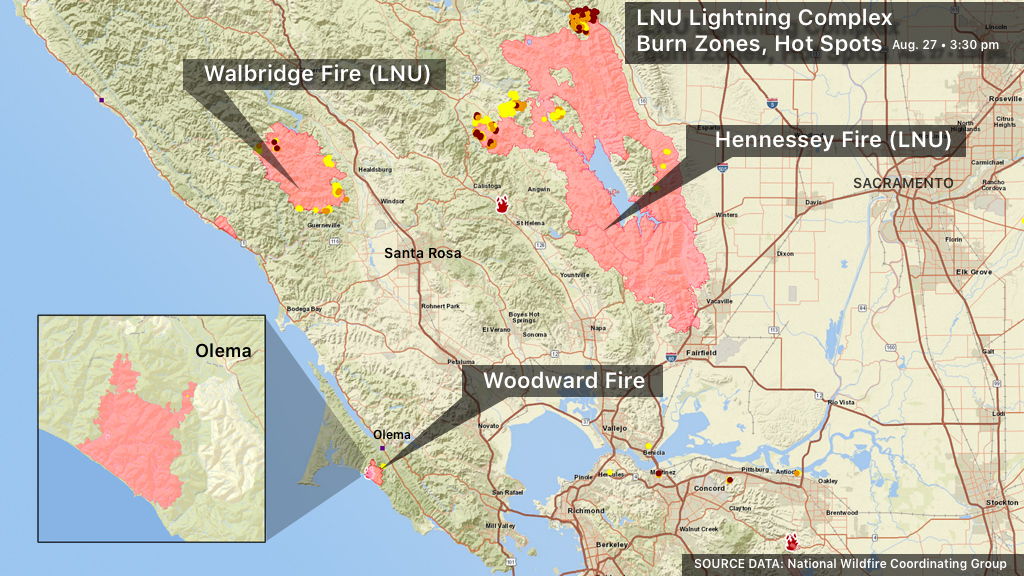
The LNU Lightning Complex is a series of lightning-caused fires that began August 17 and are spread across six counties. The main fires are the Hennessey Fire (Merged Fires - Gamble, Green, Aetna, Markley, Spanish, Morgan, Round), the Walbridge Fire (merged with Stewarts), and the Meyers Fire.
COUNTIES: Multiple locations in Colusa, Lake, Napa, Solano, Sonoma, Yolo counties
ACRES BURNED: 375,209 (Aug. 30)
CONTAINMENT: 56 percent (Aug. 30)
TOP STORY: 375,000 Acres Burned, 56 Percent Contained
EVACUATION ORDERS: Cal Fire Incident: Evacuations and Road Closures
EVACUATION MAPS: Lake County | Napa County | Solano County | Sonoma County | Yolo County
EVACUATION SHELTERS: Map and Information
CONTINUING COVERAGE: Latest California Wildfires Articles at CBS SF