Caldor Fire Update: Winds Whip Up Flames Along Highway 50; New Evacuation Orders Issued
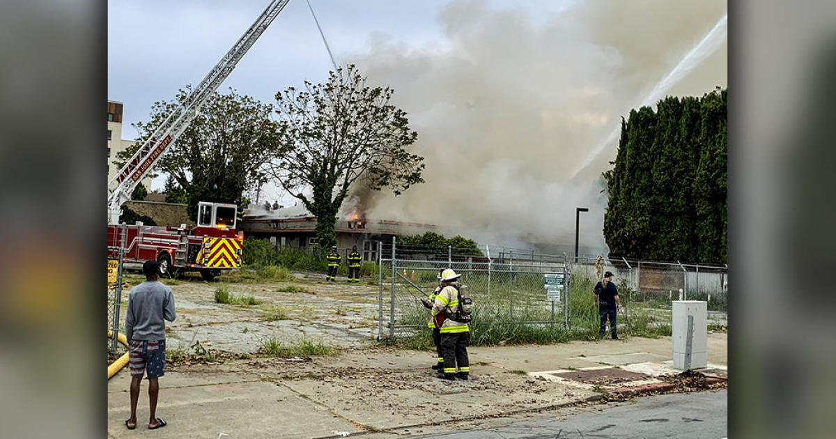
KYBURZ (CBS SF) -- Gusty up-canyon winds whipped up the Caldor Fire along Highway 50 as firefighters engaged flames near the mountain community of Kyburz Thursday, attempting to slow the blaze's advance toward the heavily populated Lake Tahoe basin.
New evacuation orders were issued for residents living in the area between Twin Bridges and Echo Summit, as well as from Highway 50 south to the Amador/Alpine County line and north to Flag Pole Peak.
Thursday afternoon, the Lake Tahoe Visitors Authority recommended visitors to postpone any travel plans to the area due to impacts from the Caldor Fire.
CALDOR FIRE:
There were also new evacuation warnings issued in El Dorado County covering Christmas Valley from Highway 89 west to Echo Summit as well as Highway 89 due west to Watershed Ridge and south to the Amador/El Dorado County line.
Additionally the Highway 50 closure has been extended east to Meyers (the junction of Highway 50 and Highway 89). Residents evacuating the area between Twin Bridges and Echo Summit are advised to use Highway 50 east.
While the fire was not making sudden runs through the timber and brush, it continued to steadily advance on its eastern edge.
Gusty winds stirred up clouds of embers well ahead of the main blaze on Wednesday, igniting spot fires beyond containment lines. One of those larger spot fires erupted along Wrights Lake Road, north of the highway, and had grown to more than 700 acres by nightfall.
"The wind was out of the southwest all day, challenging our lines," said Eric Schwab, Cal Fire operations section chief, at a community update on Wednesday evening. "Unfortunately, a spot fire threw another spot fire across Wright Lakes Road. We are currently trying to get containment on it. It's about 700 acres...We are chasing this one down. It is moving laterally."
Spot fires have been challenging.
"Ninety of every 100 embers that go out and land in the fuel are going to create an ignition this going to cause us to go mitigate that," said Steve Volmer, the chief fire behavior analyst working on the fire.
The wildfire is burning in an area that has not had a major fire or been thinned by flames prior to the 1940s.
"We are looking at very dense timber, very large diameter trees -- 40 inches in diameter," Volmer said. "Heavy dead and downed fuels. That is causing us some control issues. Those dead and downed materials are very receptive. They are extremely dry... A very receptive fuel bed."
The eastern edge of the blaze was where the most intense firefight was being waged. To the west, crews were using backfires to gain greater control of the blaze and stopping its spread along the north and middle fork of the Cosumnes River.
By Thursday evening, the fire had grown to 139,643 acres with 12 percent containment. It has ravaged the mountain community of Grizzly Flats and destroyed at least 465 homes across the burn zone.
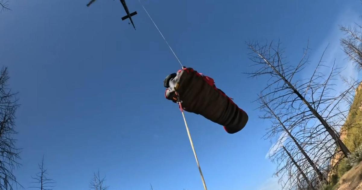
Nearly 3,000 firefighters were involved in the firefight assisted by a steady stream of helicopters and air tankers dumping retardant and water.
Firefighters will also be aided by a change in wind conditions over the next three days, according to incident meteorologist Jim Dudley. The afternoon gusty southwest winds will be calming down.
"This southerly wind flow that has been feeding into the fire area and helping to drive the afternoon south to southwest winds is going to stop," he said. "We are going to have very light winds aloft. On the ridgetops and the very critical east side of the fire, we will not have the aiding effect of the southwest winds."
The wind shift will help thin the smoke layer above Lake Tahoe.
South Lake Tahoe and Tahoe City on the west shore had the nation's worst air pollution at midmorning Wednesday, reaching 334, in the "hazardous" category of the 0-500 Air Quality Index, according to AirNow, a partnership of federal, state and local air agencies.
South of Tahoe, Rick Nelson and his wife, Diane, had planned to host a weekend wedding at Fallen Leaf Lake, where his daughter and her fiance had met. However, the smoke caused most of the community to leave. The sun was an eerie blood orange, and the floats and boats in the lake were obscured by haze Tuesday.
In the end, the Nelsons spent two days arranging to have the wedding moved from the glacial lake several hours southwest to the San Francisco Bay Area.
"Everybody's trying to make accommodations for the smoke. And I think it's becoming a reality for us, unfortunately," Diane Nelson said. "I just think that the smoke and the fires have gotten bigger, hotter and faster-moving."
While thousands of residents have been forced to flee their homes, an alleged looter was arrested on Wednesday during a patrol of evacuation area.
The El Dorado County Sheriff's Office said a suspicious man was spotted on a Pollock Pines resident's home surveillance camera.
"We got a call from a citizen actually watching one of their surveillance cameras," said Sgt. Eric Palmberg with the El Dorado County Sheriff's Office.
Deputies soon converged on the area and stopped the man. He was found with items that deputies suspected to have been stolen.
That man, identified as 51-year-old Brandon Massey, has since been arrested and is now facing charges of looting during a State of Emergency and possession of a controlled substance, among other charges.
CALDOR FIRE:
Current mandatory evacuations include:
- Grizzly Flats: The areas on Grizzly Flats Road east of Kendra Way into Grizzly Flats Proper. The areas of Diamond Railroad Grade, Old School House, Sweeney Road, Caldor Road, and steely Ridge.
- Grizzly Flats Road east of four corners in somerset into Grizzly Flats Proper.
- The areas of Myers Lane, Varmet Ridge Road, Rodwell Canyon Road, Snowbird Lane, and Mehwald Lane.
- East of Sly Park Road between Highway 50 and Mormon Emigrant Trail to Ice House Road. This includes the communities of Pacific House and Fresh Pond.
- North of Highway 50, east of Forebay Road to Ice House Road.
- Intersection of Perry Creek and Hawk Haven, the East side of Fairplay Road from Perry Creek South to Cedarville Road. This includes Slug Gulch, Omo Ranch, and all roads off of Slug Gulch and Omo Ranch.
- All roads off of Omo Ranch from Cedarville Road to Hwy 88.
- The area between Highway 88 and Mormon Emigrant Trail
- South of Highway 50 from Snows Road to Ice House Road.
- Between Highway 50 and Slab Creek from Snows Road to Ice House Road.
- South of Highway 50 from Ice House Road to Silver Fork Road. This includes the community of Kyburz.
- North of Highway 50 from Ice House Road to Silver Fork Road to include Ice House Reservoir, Union Valley Reservoir, and Loon Lake.
- Silver Fork Road in Kyburz east to Twin Bridges.
- North and south in a line extending from Twin Bridges to the Placer County line and south to the Amador County line.
- Areas south of Farnham Ridge Road and east of Bridgeport School Road to the Amador County line.
Evacuations warnings for El Dorado County and Amador County along with road closures can be found here.
© Copyright 2021 CBS Broadcasting Inc. All Rights Reserved. The Associated Press contributed to this report