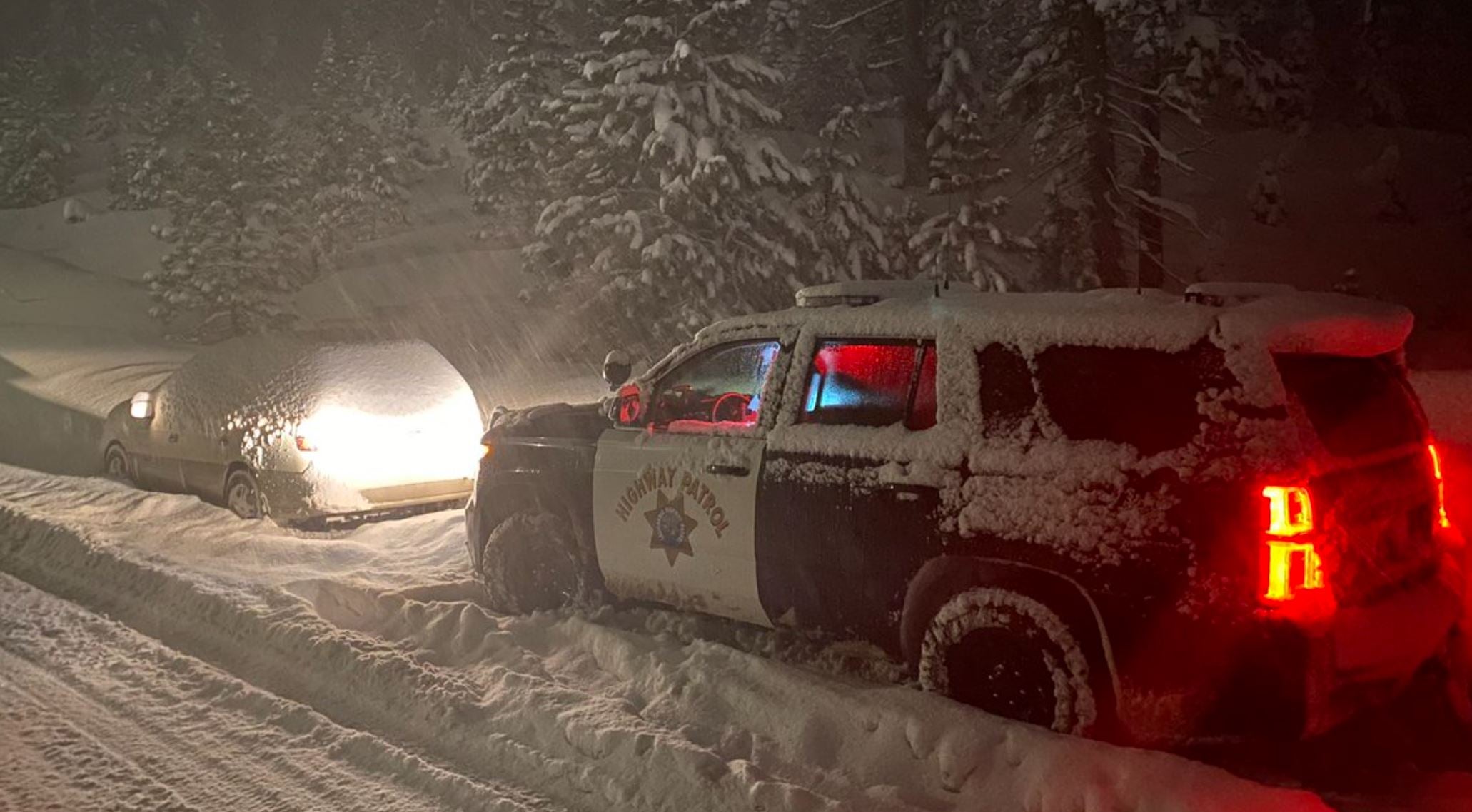
UPDATE: Blizzard Blasts High Country; Trans-Sierra Roads Closed Indefinitely
SAN FRANCISCO (CBS/AP) -- A major Christmas weekend storm caused whiteout conditions with 100 mph winds, closing key mountain highways and ski resorts amid blowing snow in the Sierra Sunday with forecasters warning that travel could be difficult for several days.
UPDATE: Avalanche Shuts Down Highway 89; I-80, Highway 50 Remain Closed; Search For Missing Northstar Skier
The blinding driving conditions triggered a 20-car pile-up on southbound Highway 395 in Washoe Valley Sunday morning. The Washoe County Sheriff's Department said at least three people were injured and the highway had been shutdown.
A 70-mile stretch of I-80 was shut down Sunday from Colfax through the Lake Tahoe region to the Nevada state line. It was not expected to reopen until Monday at the earliest.
Caltrans said late Sunday afternoon that Highway 50 would remain closed in both directions between Placerville and Meyers due to heavy snow, at least until Monday. The agency will reassess the conditions Monday but does not have an estimated time of reopening.
"Highway 50 is currently closed," the CHP posted. "We cannot make it more clear ... Please don't attempt to drive to the snow."
"Expect major travel delays on all roads," the National Weather Service office in Reno, Nevada, said on Twitter. "Today is the type of day to just stay home if you can. More snow is on the way too!"
Officials at Palisades Tahoe were forced to shutdown their lifts on Sunday.
"The snow that fell since Friday night came in with high winds and cold temperatures, resulting in low-density, light snow," resort officials said in a news release. "The winds are expected to remain high, with gusts of over 100 mph for the remainder of the day. Strong winds blow around the light snow that has accumulated, resulting in virtually no visibility on the mountain."
Over the last 24 hours, the resort has received more than 2 feet of new snow.
Meanwhile, Northstar near Truckee received 34 inches of fresh snow at the summit and 27 inches at mid mountain overnight into Sunday morning.
"With the interests our both our employees and guests in mind, we will not be opening today due to blizzard conditions on the mountain," Northstar officials posted on their website Sunday. "We appreciate everyone's patience this morning, but mother nature had other plans."
At Donner Pass in the Sierra officials with the University of California, Berkeley's Central Sierra Snow Laboratory wondered on Twitter if the recent snowfall could break the snowiest December record of 179 inches set in 1970.
There's been at least 119 inches recorded so far this month with more expected over the next 72 hours.
The snowpack in the Sierra was at dangerously low levels after recent weeks of dry weather but the state Department of Water Resources reported on Christmas Eve that the snowpack was between 114% and 137% of normal across the range with more snow expected.
A winter storm warning stretching all the way to Tuesday has been issued by the National Weather Service for the Lake Tahoe area.
"The Sierra Nevada which has already picked up locally several feet of snow over the last few days is expected to see an additional 2 to 5 feet of snow going through Tuesday," the weather service said.
Sunday Snow Forecast (NWS) 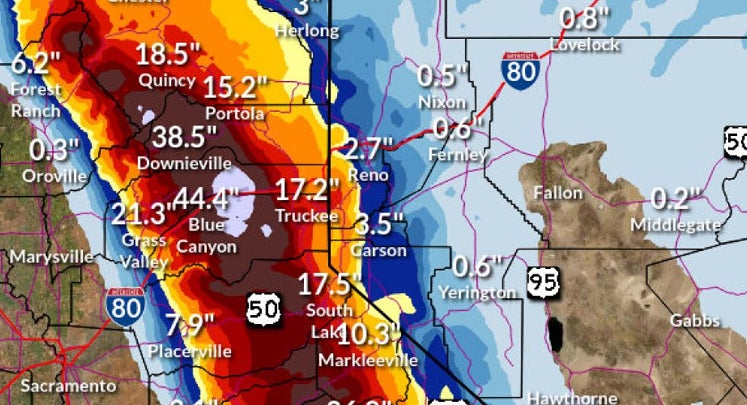
Another dose of blinding snow storms and high winds were creating a scenario ripe for avalanches.
"High avalanche danger is expected through Monday morning in the mountains," NWS forecasters said. "Heavy snowfall and extremely strong winds have created unstable avalanche conditions in the mountains. Large natural avalanches and human-triggered avalanches are expected."
© Copyright 2021 CBS Broadcasting Inc. All Rights Reserved. The Associated Press and Bay City News contributed to this report