Ask An Expert: Best Bike Rides In The East Bay
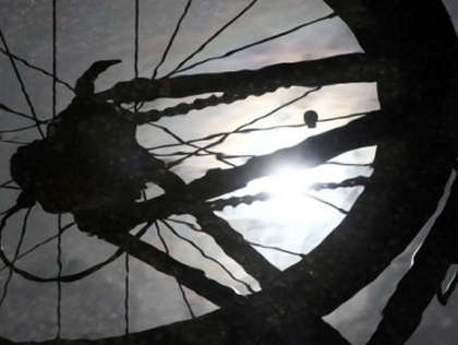
With the rainy season ending and the prospect of longer and warmer days blessing the Bay Area, both residents and tourists can look forward to spending more time outdoors. While some Bay Area cyclists do what they can to cycle year round, others will wait until roads are dry to resume cycling or even trying out cycling for the very first time. Although San Francisco is noted for being one of the nation's top cities for biking, many of the best bike routes can actually be found in the East Bay, not only because of its sheer size, but also because of the availability of bike rides on quiet country roads, amid sweeping views of the bay.
Garry Birch
Race Team President - Team Fremont/FFBC Powered by Chipotle
4700 Calaveras Ave.
Fremont, CA 94538
(925) 819-0247
www.ffbc.org
Garry Birch, Race Team President for Team Fremont, offers five of the best East Bay bike rides, from easy rides for beginners to very challenging rides for advanced and even world-class cyclists. Team Fremont is the official race team for the Fremont Freewheeler Bicycle Club, a non-profit club that has operated in the East Bay for over 40 years.
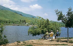
Pleasanton Loop - Easy
This is a mostly flat and easy 10-mile route that begins at Shadow Cliffs Regional Park in Pleasanton. From the short, but slightly challenging climb from the park, the route heads away from the city for three miles along Stanley Boulevard before turning right onto Isabel Avenue for a few miles. At Vineyard Avenue, cyclists then bear right and travel for approximately another three miles before turning right onto Valley Avenue and then right onto Stanley, and back to the park. This route is a perfect training ride for the beginning cyclist and travels past a few of Pleasanton's finest wineries. A similar route is used during the summer months for a series of triathlons that are arguably the Bay Area's best races for beginning triathletes.
Redwood Road/Pinehurst Road - Moderate
This 45-mile route of moderate difficulty begins at the Castro Valley BART station. From the transit station, cyclists then head up Redwood Road towards the hills and Chabot Regional Park. This route then passes by the Upper San Leandro Reservoir and awards riders with some glorious views of the East Bay. The route then continues past Saint Mary's College in Moraga and then through the communities of Orinda and Rossmoor, before descending to Danville Boulevard and Crow Canyon Road, and capping off the ride on flat roads back to Castro Valley.
Calaveras Loop - Moderate to Difficult
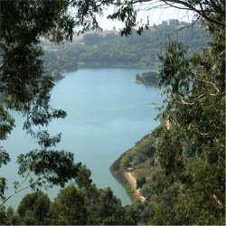
A moderate to difficult 38-mile route with 2,200 feet of climbing, this ride begins at Mowry Avenue and Mission Boulevard in Fremont, not far from the Niles Community Park and Quarry Lakes Regional Park. Cyclists will travel up Niles Canyon Road for 6.5 miles before turning right on Paloma Way and onto the scenic Calaveras Road for about 15 miles, while passing by Calaveras Reservoir. Cyclists then continue along Calaveras Road through Ed Levin County Park. The park is a popular rest spot for cyclists, providing restrooms and water fountains. After leaving the park, riders will descend back towards the City of Milpitas, with an easy finish towards Fremont.
Palomares Loop - Moderate to Difficult
Beginning again at Mowry Avenue and Mission Boulevard in Fremont, the Palomares Loop is a moderate to difficult 30-mile bike route that's perfect for the intermediate level. Cyclists will head up Niles Canyon Road and then proceed left onto Palomares Road, which features a challenging 4.5-mile, 1000-foot vertical climb. After the toughest portion of the ride, there is a descent through Castro Valley, before the route flattens out after mile 12, towards the City of Hayward. From there, it's a rewarding flat ride before returning to Fremont.
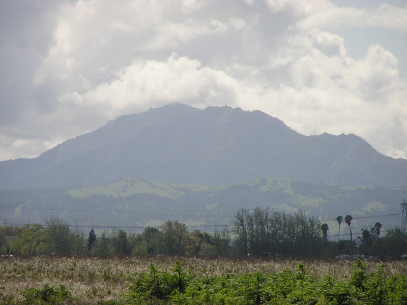
Mount Diablo - Difficult
The undisputed toughest bike ride in the East Bay is scaling up the 3,848-foot summit of Mount Diablo. There are multiple routes up to the East Bay's highest peak, with Danville's Athenian School serving as the starting point for an event billed as "the East Bay's Best Uphill Bike Ride," also known as the Mount Diablo Challenge. This road ride is just over 11 miles, with an elevation gain of 3,249 feet and an exhilarating finish at the summit. Of course to extend the ride, cyclists can just turn around and descend back to the school. Other more challenging rides to the top of Mount Diablo can begin at other East Bay locations, including the City of Walnut Creek, Castro Valley and Fremont. Mount Diablo is one of the featured stages during the Amgen Tour of California held in May that showcases many of the world's top professional cyclists.
Randy Yagi is a freelance writer covering all things San Francisco. His work can be found on Examiner.com.