Two Die In Storm-Related Accidents As Winds And Rain Lash Bay Area
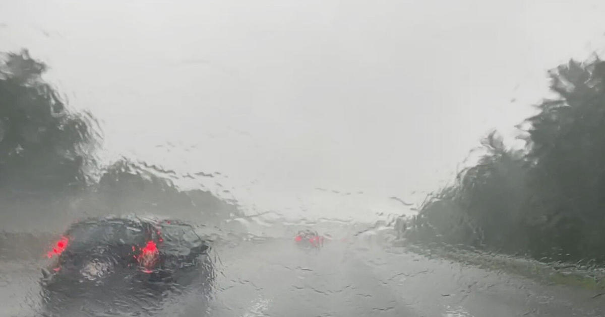
SAN FRANCISCO (CBS SF) -- A potent winter storm front, churned to life in the Gulf of Alaska and fueled by tropical moisture from near Hawaii, roared into the Bay Area Wednesday, toppling trees, causing mudslides and contributing to the deaths of two people.
Police said Oakland firefighters responded to reports of a large tree branch down along Ardley Ave. near Interstate 580 on Caltrans property. Firefighters found a male victim dead under the branch, which was 12 inches in diameter and about 30 feet long.
Police said that location next to I-580 is frequented by homeless people.
CHP Napa said that one person was killed in a two-vehicle accident at about 3 p.m. on Highway 121 near Schellville. CHP said that the accident was caused by driver speed and the wet roadway as one vehicle crossed a double yellow line and lost control.
The National Weather Service issued a flash flood watch for the entire Bay Area running until 3 a.m. Thursday. Forecasters were predicting 1-3 inches in the valleys with 3-6 inches in the mountains. The Santa Cruz Mountains may see even higher amounts.
The front also brought damaging winds that knocked down trees and power poles across the region. Winds in the 35-45 mph range were measured throughout the Bay Area with and gusts up to nearly 70 mph in a number of places. Those gusts blew even harder in the North Bay, with winds measure as high as 98 mph at Big Rock Ridge near Novato. A high-wind warning was also issued for the Bay Area.
High winds blew over a big rig on the Richmond-San Rafael Bridge and blocking two eastbound lanes around 8 p.m., according to CHP Marin. The driver was not injured, but there were still no reports as to when crews would be able to remove the vehicle.
Dozens of trees were reported down across San Francisco, with one tree falling onto a house in Laurel Heights.
The storm was also affecting electricity service across the Bay Area, though problems were concentrated in the North Bay. The largest single outage was in Petaluma, impacting approximately 5,550 customers.
Outages continued to spread as the evening wore on, with the number of people in the North Bay without power rising to over 38,000, while the Peninsula and the South Bay outages grew to just over 18,000 and 19,645, respectively. Outage numbers in the East Bay (4,613) and San Francisco (2,265) were much lower. A total of over 82,000 customers were without power as of 9:30 p.m.
Compounding the storm threat was soil already saturated from showers last week and also on Monday and Tuesday. Ben Lomond in the Santa Cruz Mountains received 3.3 inches over the 24 hours ending late Wednesday, while Las Cumbres Peak received nearly 4.5 inches.
The mountainous parts of Sonoma County receiving the most rain with 6.56 inches by midnight Wednesday. In Napa County, Atlas Peak received nearly 4.5 inches of rain, but most of the county was more in the 2.5-3.5 range.
Most other parts of the Bay Area including San Francisco, Contra Costa and Alameda counties received between 1-2.5 inches of rain, with some exceptions like Pescadero Creek which got whopping 5.7 inches in the past 24 hours. Santa Clara County had a similarly wide range, with San Jose only receiving about an inch while some western areas of the county towards the coast got between 4-5 inches.
The first wave of stormy weather was over the Bay Area as of 1 p.m., with the second even stronger front mostly passing through by 9 p.m., though some rains continued well after.
Shortly before 4 p.m., a mudslide on Highway 17 blocked both southbound lanes south of the Glenwood Cutoff in Scotts Valley. Within about 20 minutes, one lane was reopened as crews waited for equipment to open the second lane.
The roadway was completely cleared shortly after 6 p.m.
Driving on Highway 101 in the South Bay was dangerous too. The hard rain didn't hit San Jose until about 2 p.m., but when it did, it hit hard.
Several cars spun out and went off the freeway in the heavy rain. The first car lost control and left the freeway near Metcalf Road. Luckily, no one was hurt.
Moments later, a second vehicle spun out, flew off the road and rolled, landing back on its tires. The driver injured his arm and he went to the hospital.
Shortly before 7 p.m., San Jose police and fire units along with PG&E crews were at the scene of downed wires on Curtner Avenue and Leigh Avenue. Curtner was closed and residents were asked to avoid the area.
At about 3:24 p.m., a flash flood warning was issued for an area of the North Bay including Petaluma and Penngrove, according to the National Weather Service. The warning expired at 5:15 p.m.
Additional flash flood warnings were issued for parts of Sonoma County early Wednesday evening. One covering the area that includes Sebastopol, Graton and Forestville that was sent out just before 5 p.m. expired at 5:45 p.m.
A short warning for both east central Sonoma County and southwestern Napa County was issued around 7:30 p.m. and it expired at 8:45 p.m.
Southeast Sonoma County was also affected; portions of Santa Rosa, Petaluma and Rohnert Park were included in a warning that lasted until 11:15 p.m. Yet another warning for an area just east of Sonoma that included Boyes Hot Springs and Temelec was issued at 6:22 p.m. and wasn't set to expire until 10:15 p.m.
Marin County Fire reported Wednesday evening that multiple downed power lines had closed Lucas Valley Road. The roadway was not expected to be cleared for at least 24 hours.
Flooding in Napa had shut down CA-121 with all lanes in both directions closed for over five hours, but all lanes were reopened with residual delays at 9:00 p.m.
Authorities said traffic was being diverted to Ramal Road in Sonoma and Duhig Road in Napa. Motorists are advised to expect delays and to use alternate routes to avoid the area. There currently is no estimated time to reopen the roadway.
Earlier Wednesday afternoon, the National Weather Service issued a small stream flood advisory that covered the San Francisco Bay Area and the Santa Cruz Mountains.
Treacherous weather closed down a stretch of the Great Highway in San Francisco by early afternoon. Southbound lanes were shut down from Lincoln Highway to Sloat Boulevard at around 2 p.m., according to SF Public Works.
It is unknown when the lanes will reopen.
Heavy rain led BART to temporarily close the Civic Center Station at around 2:50 p.m. Wednesday because of flooding on the underground station platform. BART reported that a leak from the San Francisco Muni platform a level above was causing the problem. The station reopened shortly before 3:30 p.m.
Later at around 5:45 p.m., the agency reported major delays in Antioch due to an obstruction on the tracks. Trains were reportedly being sent back in the San Francisco direction at the Pleasant Hill station according to comments on social media, but BART had yet to clarify the situation.
BART officials later clarified that a falling tree actually struck a train on the tracks between Concord and Pleasant Hill. While no one on the train was injured and the tree didn't cause any major damage, crews were working to remove the tree.
Downed trees and power lines were impacting traffic and Muni service in San Francisco as well. A downed tree near Lombard and Lyon streets was blocking the 43 bus line, causing delays and forcing reroutes as of about 4:40 p.m.
A downed power line in the Sunset District forced the L Taraval streetcars to switch back at 46th Avenue between Ulloa and Vincente at around the same time. The downed wire was cleared and service for the L Taraval restored by 5:30 p.m.
The San Francisco Fire Department tweeted out about the downed power line incident as well as trees down at Ninth Avenue and Pacheco, the 2600 block of Diamond, the 100 block of Hoffman and the 200 block of Church Street. Firefighters and city crews were at all of those scenes.
The storm was also creating havoc at San Francisco International. By late afternoon, 156 flights had been cancelled and approximately 469 had experienced delays.
The Oakland International Airport had minimal service impact from the storm, while San Jose Mineta International Airport had a handful of cancellations and delays.
Earlier in Monterey County, a giant boulder crashed down on Highway 1, forcing the closure of the roadway. Fortunately, no one was injured.
![]()
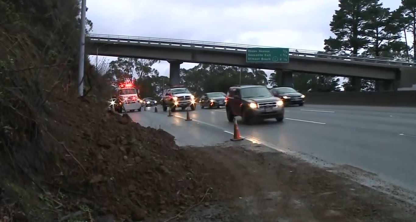
Wednesday morning's commute was slowed in Marin after a minor mudslide shut down one lane at the Waldo Grade.
Elsewhere, several trees had also toppled including a large oak that fell on Withers Ave. on the Pleasant Hill/Lafayette border.
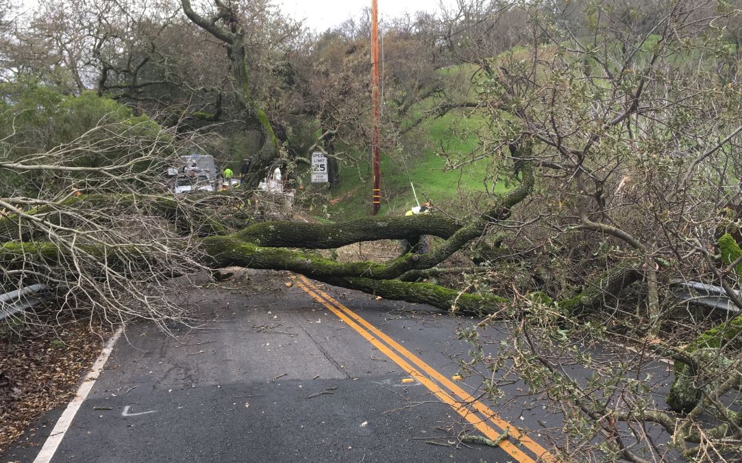
Property owner Victoria Werhan said the tree falling sounded like thunder and shook her whole house. She said it was lucky the tree didn't fall earlier in the morning, because there are usually cars lined up on the street taking kids to school.
"It was good that the school traffic had ended and there was nobody on the road at the time," she said. "An hour earlier, it would have been a lot sadder story."
The tree may already have a sad story. The creek it sat in is known as "Murderer's Creek" because in the mid-1800s, a survey crew found a man hanging from an oak tree in that very area. Neighbors have always wondered if today's fallen oak could have been that tree.
"As we're cutting the tree we're noticing water coming out of the tree and so that tells us that the roots gave out," said Steve Padilla, PIO for Contra Costa County Public Works. "The water saturated the tree and it just couldn't handle it anymore."
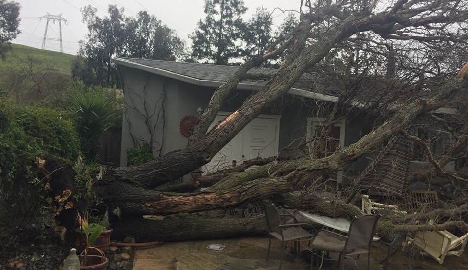
In San Jose, a tree toppled into a pool house/cottage. The homeowner told KPIX 5 that a huge gust came up and the tree just went.
Forecasters and the California Highway Patrol were warning Bay Area drivers to be ready for a challenging evening commute.
"The combination of heavy rain, areas of roadway flooding, strong winds, and tree/powerline damage will create very hazardous driving conditions Wednesday afternoon and evening," the weather service said.
The weather service also predicted the run-off would create dangerous conditions on local waterways.
"The Russian and Napa Rivers will show rapid rises but remain below flood stage on Thursday," the weather service said. "Keep in mind some of the other rivers may have delayed responses due to run-off and not peak until Thursday afternoon."
"Small creeks and streams in the North Bay, Santa Cruz Mountains and Alameda Creek near Niles Canyon will also be susceptible to rapid and dangerous rises."
A blizzard warning for much of the Sierra Nevada and Lake Tahoe was to go into effect Wednesday night, with meteorologists predicting as much of five feet of snow in upper elevations and wind gusts of up to 100 mph on ridgetops. Chains will be required on Highways 50 and 80.
An avalanche warning was also in effect for the Tahoe area until 7 a.m. Friday.