What's Up With All the Late-May Rain? Atmospheric Science Suggests Answers
SAN FRANCISCO (KPIX) -- What's up with all of this Bay Area rain in May?
For anyone fascinated with Bay Area weather, this has been a good week to do some questioning. If you've been wondering, there are some good explanations -- some straight-forward, others a bit more complicated.
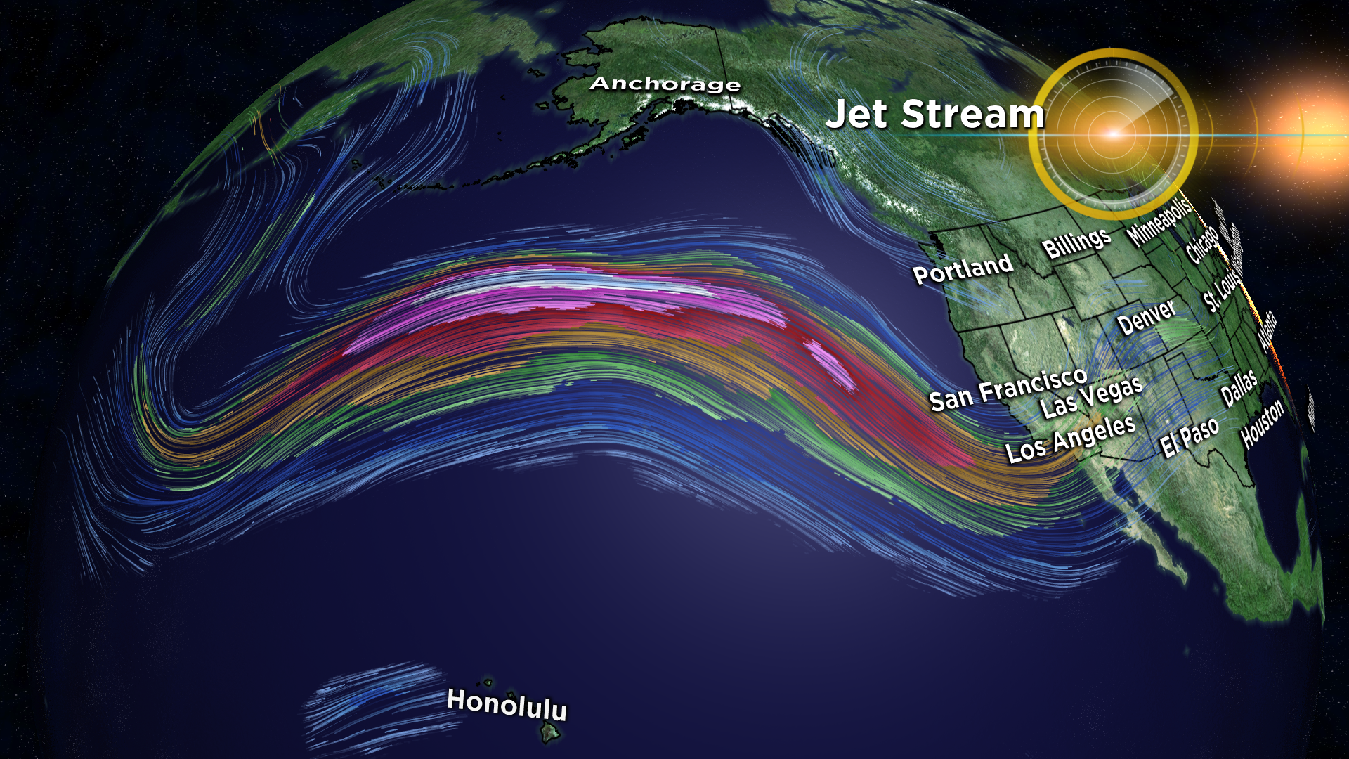
The first: an unusually strong jet stream racing across the Pacific is pointed directly at California. The jet stream is the fast-moving freeway of winds in the upper atmosphere which most of our storms ride in on.
The jet stream is currently behaving as if it's the dead of winter rather than late spring -- it's well organized and tracking farther south than normal and is also aimed right at the West Coast.
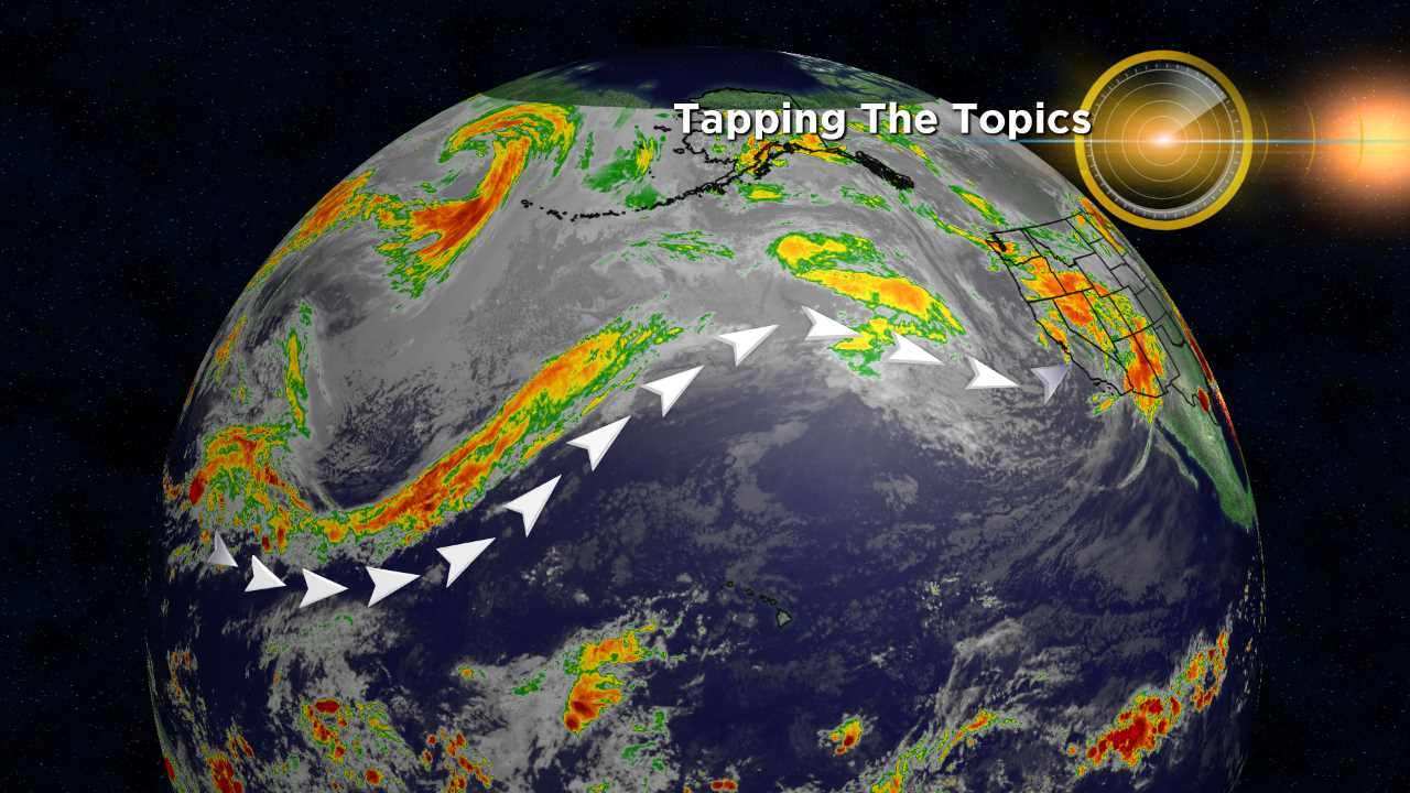
At the same time, and on the other side of the Pacific, a large complex of thunderstorms is marching across the tropics. Those thunderstorms are part of a well known cycle called the Madden-Julien oscillation (or MJO). What matters most is that the current cycle places them in just the right location for our overzealous jet stream to reach down, rip the excess moisture off their tops and hurl it across the Pacific at California.
This process is an excellent way to create an atmospheric river storm system. We just got hit with two of them: Wednesday's soaker and now this weekend's repeat soaker. Atmospheric rivers are narrow regions of high water vapor content which occasionally get pulled out of the tropics and drawn into storms in the mid latitudes where we live.
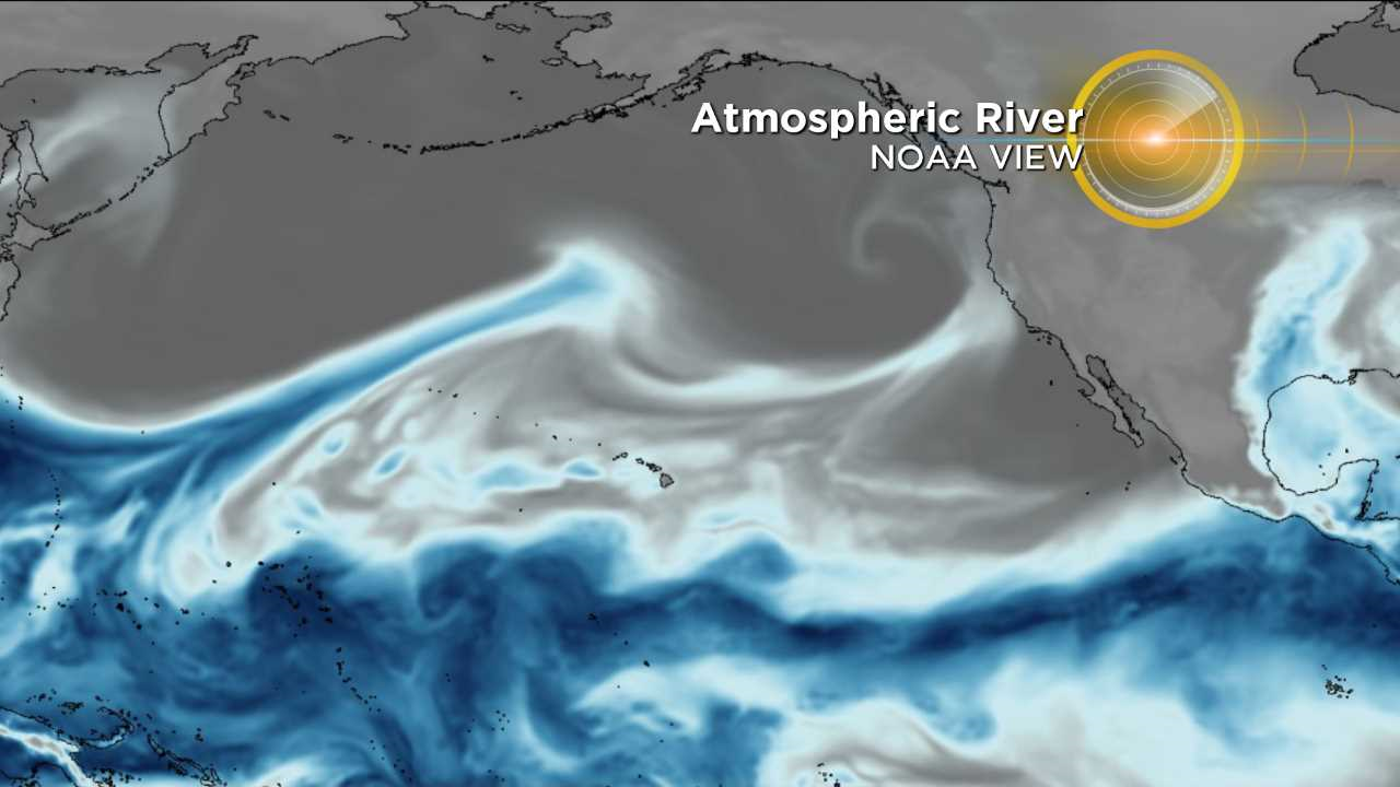
Atmospheric rivers have only recently been recognized by the scientific community as significant players in California's water cycle. They provide over half of our winter precipitation and have been responsible for most major flooding events in state history. Fortunately the two ARs we just experienced were technically categorized as "weak" -- more beneficial than menacing.
Now that we've got the basic explanation down, there is one large question hanging out there: What's causing the jet stream to behave like the depths of winter when it's actually the middle of spring?
In order to answer that question we begin to enter new and emerging fields of atmospheric science, where the answers -- while tantalizing -- are not necessarily as concrete as we might like them to be. Nevertheless, since there is enough reasonable insight being gained by leading academics in the field, let's head down that rabbit hole.
In case you hadn't heard, the arctic has been experiencing a relentless grind of well-above-average temperatures for the entire month of May.
One of the more interesting ideas to come out of the scientific community in recent years is the connection between a rapidly-warming arctic and the resulting exaggerated pattern in the jet stream across the rest of the globe.
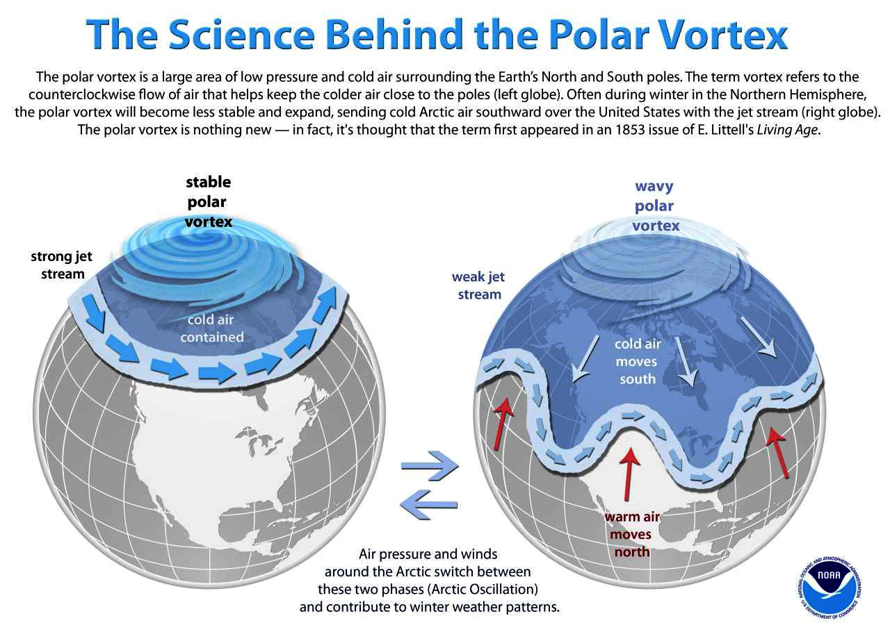
The general thought is, with warm temperatures in the arctic, there is less of a temperature difference between the poles and locations to the south. Big differences in temperatures drive jet streams. As the poles warm, the polar jet weakens. You can think of the polar jet as the corral holding the colder air up north near the pole. When the winds weaken, the gates to the corral open and relatively cold air starts pouring south.
We've heard of this several times over recent winters as the over-hyped "polar vortex" made headlines. The same exaggerated swings in the atmosphere which unfold during one of those events in winter is actually playing out right now but on a less-exaggerated scale because we're well into spring.
So, in terms of explaining this week's intense jet stream, we're likely seeing the effects of a batch of runaway arctic air slinking far enough south to energize and reinvigorate the subtropical jet stream.
If true, we can thank the "relentless grind" of warmth in the Arctic this month for our unusually rainy May here in the Bay Area.
Of course, often the weather just does what it does and, for many people, that explanation will suffice. However, when the weather defies our expectations, it's only natural to wonder why.
That's what drives science forward.