CZU Lightning Complex: Nearly 1,200 Structures Destroyed, Containment At 35%
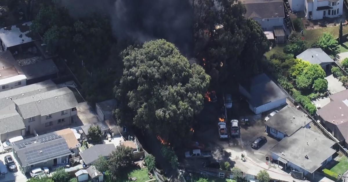
SANTA CRUZ COUNTY (CBS SF) – As firefighters entered their third week of battling the CZU Lightning Complex, containment of the fires has grown to 35 percent as of Sunday. Meanwhile, the number of structures destroyed has reached nearly 1,200.
Cal Fire announced in its Sunday morning update that the fires burning in southern San Mateo and northern Santa Cruz counties have burned 84,640 acres (132.25 square miles) since they were sparked on August 16th.
Officials said damage inspection is 90 percent complete. As of Sunday, 1,177 structures have been destroyed, including 756 residences, along with 123 non-residential commercial structures, one mixed commercial / residential structure and 297 other minor structures. About 125 structures have been damaged, including 84 residences.
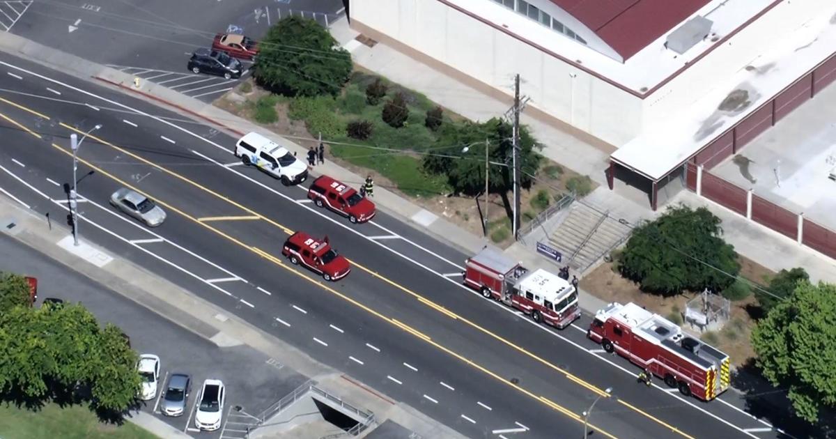
Aided by cooler weather, Cal Fire said they worked aggressively overnight to build containment lines, but officials are concerned about warmer temperatures later this week.
"We're expecting with our updated weather from our incident meteorologist that about Wednesday to Thursday, that's when we'll see a big change in the weather," Battalion Chief Mark Brunton said in a Q & A posted Sunday morning. Brunton said that winds would shift, from an onshore flow to hotter and drier conditions.
About 40,000 people remain evacuated, but Brunton noted that repopulation happened in more communities on Saturday, including in Davenport on the coast, along with Felton in the Santa Cruz Mountains.
The fire has killed one person and has injured another, Cal Fire said.
It remains unclear when the fire would be fully contained.
CONTINUING COVERAGE: Recent California Wildfires Articles at CBS SF
EVACUATION ORDERS FOR SAN MATEO COUNTY (As of 8/30/20):
- Communities of Loma Mar and Dearborn Park Area (Zone SMC E018) (8/18/2020 5:00 pm)
- Pescadero Creek County Park Area (Zone SMC E024)) (8/18/2020 4:30 pm)
- Butano Community Area (Zone SMC E098) (8/18/2020 5:00 pm)
- Butano State Park Area including Barranca Knolls Community (Zone SMC E019) (8/18/2020 4:30 pm)
- Butano Creek Drainage (Zone SMC E055) (8/18/2020 4:30 pm) (8/18/2020 4:30 pm)
- South Skyline Blvd. Area near Highway 9 (SMC E049) (8/18/2020 11:00 pm)
- Russian Ridge Open Space Reserve Area (Zone SMC E027) (8/18/2020 11:00 pm)
- (Zone SMC E048) (8/18/2020 11:00 pm)
- Red Barn Area (Zone SMC E010) (8/20/2020 6:00 pm)
EVACUATION ORDERS FOR SANTA CRUZ COUNTY:
- Waterman Gap Loop, Upper HWY 236, Boulder Creek Golf Course, Heartwood Hill, Lodge Road, Community of Little Basin, Lower China Grade, Upper China Grade, Community of Kings Hwy, Lower Jamison Creek, Gallion Heights, Fallen Leaf Neighborhood, Foxglove Lane (Zones CRZ10, CRZ13, BOU36, BOU20, BOU30, BOU31, BOU36, BOU37, BOU21) (8/18/2020 10 pm)
- Saratoga Toll Road, San Lorenzo Park, Riverside Grove-Community of Teilh Drive, Wildwood Road (BOU38, BOU39, BOU40, BOU41, BOU42, BOU43) (8/18/2020 10 pm)
- Everyone on Empire Grade Road, from Felton Empire north, all of Pine Flat Road, all of Ice Cream Grade, Bonny Doon Road, in between Pine Flat Road, Martin Road, and all associated side streets are under an evacuation order. Areas west of State Route 35 from San Mateo County Line to State Route 17. (CRZ1, CRZ2, CRZ3, CRZ4, CRZ5, CRZ10, CRZ11, CRZ12, CRZ13, CRZ14, CRZ15) (8/19/2020 1:00 am)
- Bonny Doon south of Ice Cream Grade, to include Pine Flat Road South. (CRZ7, CRZ8) (8/19/2020 1:00 am)
- Areas of Alba Road, Hubbard Gulch and Fanning Grade. (BEN 1) (8/19/2020 6:00 pm)
- All areas of Ben Lomond (Zones BEN 2 – BEN 5) (8/19/2020 7:00 pm)
- All areas adjacent to the Bonny Doon and San Lorenzo Valley should be prepared to evacuate if necessary. (CRZ7, CRZ8) (8/20/2020 1:00 am)
- Areas West of Highway 9 to Empire Grade
- South from Bear Creek Road to Felton, this includes Ben Lomond
- The areas of Zayante Canyon (Zones: ZAY 1 – ZAY 17) (8/20/2020 1:00 pm)
- Davenport south (Zones: CRZ 6, CRZ 9, CRZ 17) (8/19/2020 7:00 pm)
- All areas of Felton (Zones: FEL 1 – FEL 6) (8/20/2020 8:00 am)
- Butano State Park area including Barrranca Knolls Community (Zone: SMC E019) (8/18/2020 4:30 pm)
EVACUATION CENTERS
San Mateo County
- Half Moon Bay High School, 1 Lewis Foster Drive, Half Moon Bay
Santa Cruz County
- Santa Cruz County Fairground, 2601 E. Lake Avenue in Watsonville
- Santa Cruz Civic Auditorium, 307 Church Street, Santa Cruz (AT CAPACITY)
- Seventh Day Adventist Camp Grounds, 1931 Soquel San Jose Rd (AT CAPACITY)
- Cabrillo College, 6500 Soquel Drive, Aptos CA
- Simpkins Family Swim Center, 919 17th Ave (ADA only)
- Twin Lakes Church, 2701 Cabrillo College Drive
ROAD CLOSURES
Road closures are fluid and being coordinated with evolving evacuation warnings and orders.
San Mateo County
- State Route 1 at Gazos Creek
- Cloverdale Road between Pescadero Creek Road and Gazos Creek.
- Pescadero Creek Road at Butano cut off
- Pescadero Creek Road at Burns Valley Road
Santa Cruz County
- State Route 1 at Lower Swanton Road to Ano Nuevo
- Back Ranch Road at Majors Road
- Warnella Road at Cement Plant Road
- State Route 9 at State Route 35 to San Lorenzo Valley High School
- Empire Grade at Twin Gates
- Empire Grade at The quarry entrance
- Felton Empire grade at The Felton Cemetery
- Bear Creek Road at Amber Ridge Loop to Boulder Creek
- Quail Hollow Road at Marion Way
- Hihn road at Stanford Drive
Animal Evacuation Center:
Santa Cruz County Fairgrounds, 2601 E. Lake Avenue in Watsonville
Large farm animals are being accepted at Cowpalace. For information and assistance contact (650) 450-0520.
Watsonville Animal Shelter, 580 Airport Blvd