Glass Fire Update: Residents Flee Area Around St. Helena; New Boysen, Shady Fires Force Evacuations Near Santa Rosa; Wall Of Flames Jumps Silverado Trail
ST. HELENA (CBS SF) -- The raging Glass Fire roared through wine county near St. Helena Sunday night as two additional wildfires forced mandatory evacuations near Santa Rosa and left a path of new destruction in a region already ravaged by blazes.
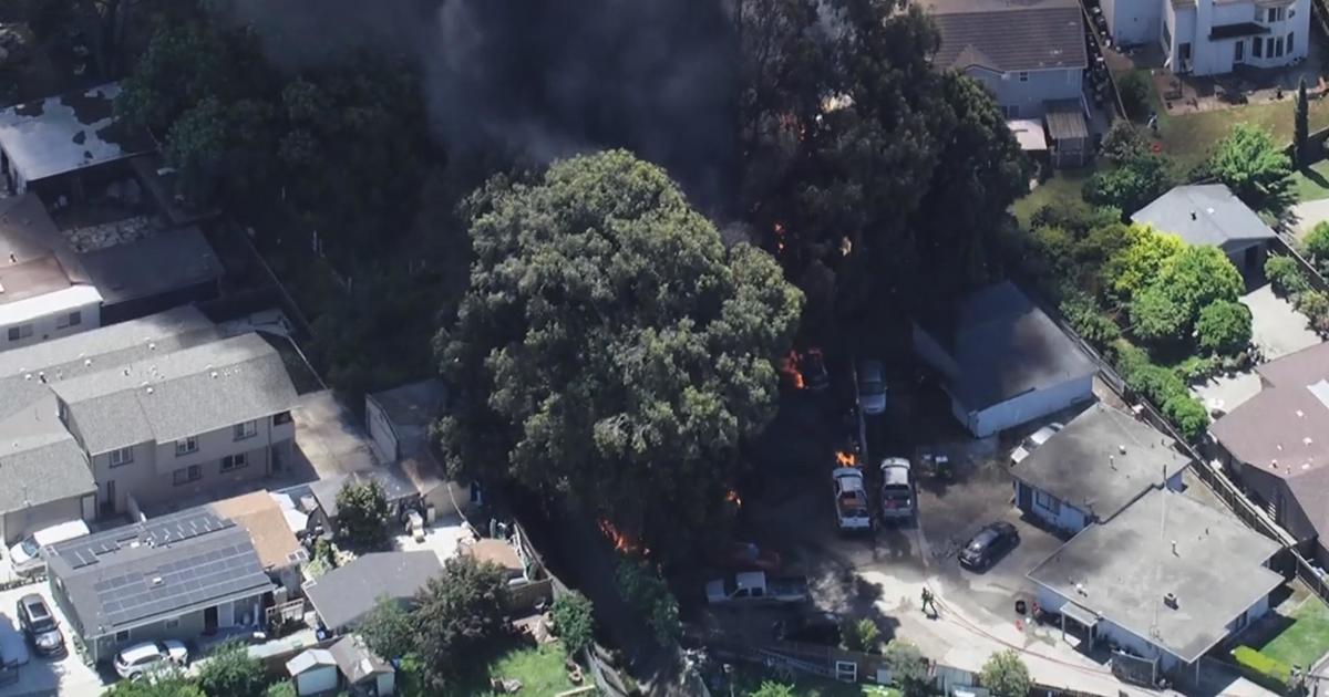
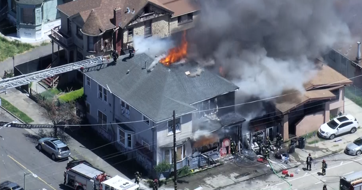
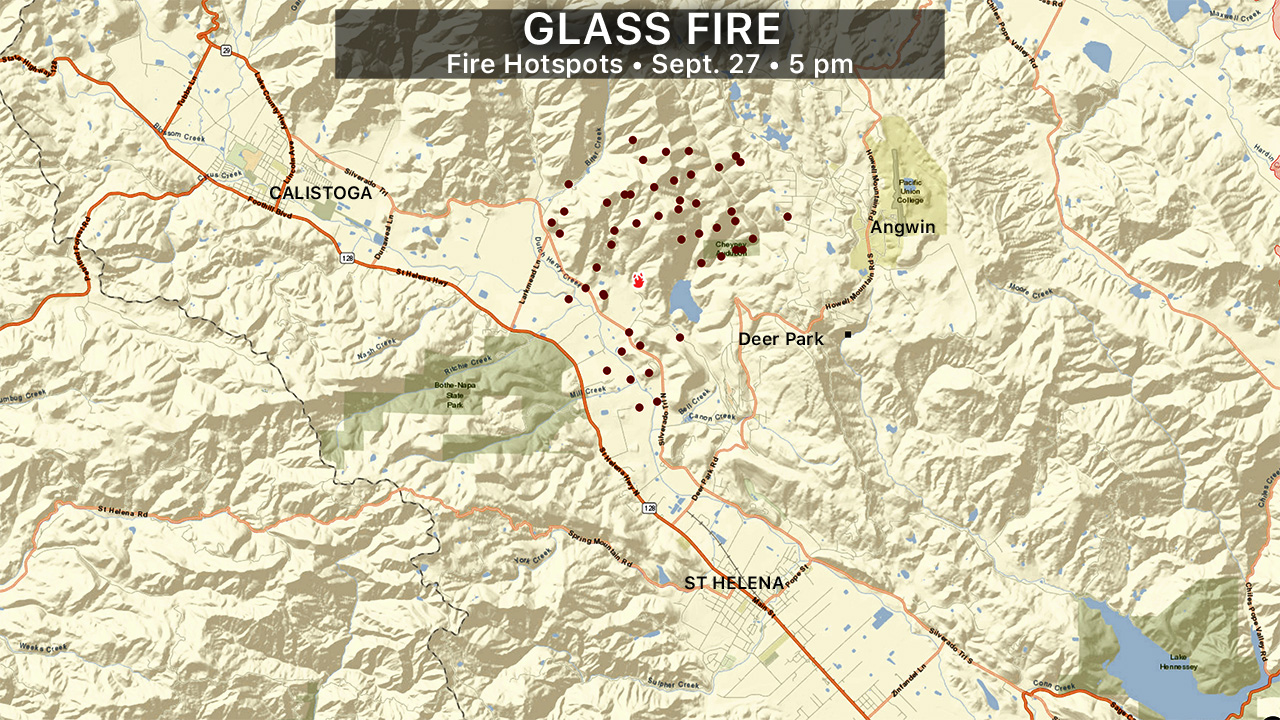
The Glass Fire quickly grew to more than 2,500 acres, burning through vineyards, destroying structures and driving at least 2,000 local residents from their homes.
Latest Wildfire Updates: Glass Fire | Shady Fire | Zogg Fire
On Sunday evening, a small army of firefighters was waging a fierce battle with the fire, trying to keep it from jumping the Silverado Trail, but it appeared the flames had crossed the major roadway in several places. A wall of flames was threatening the Adventist Health St. Helena hospital (which had been evacuated earlier Sunday) and homes in Deer Park.
By shortly before 10 p.m., the fire had jumped both the Silverado Trail and the Napa River.
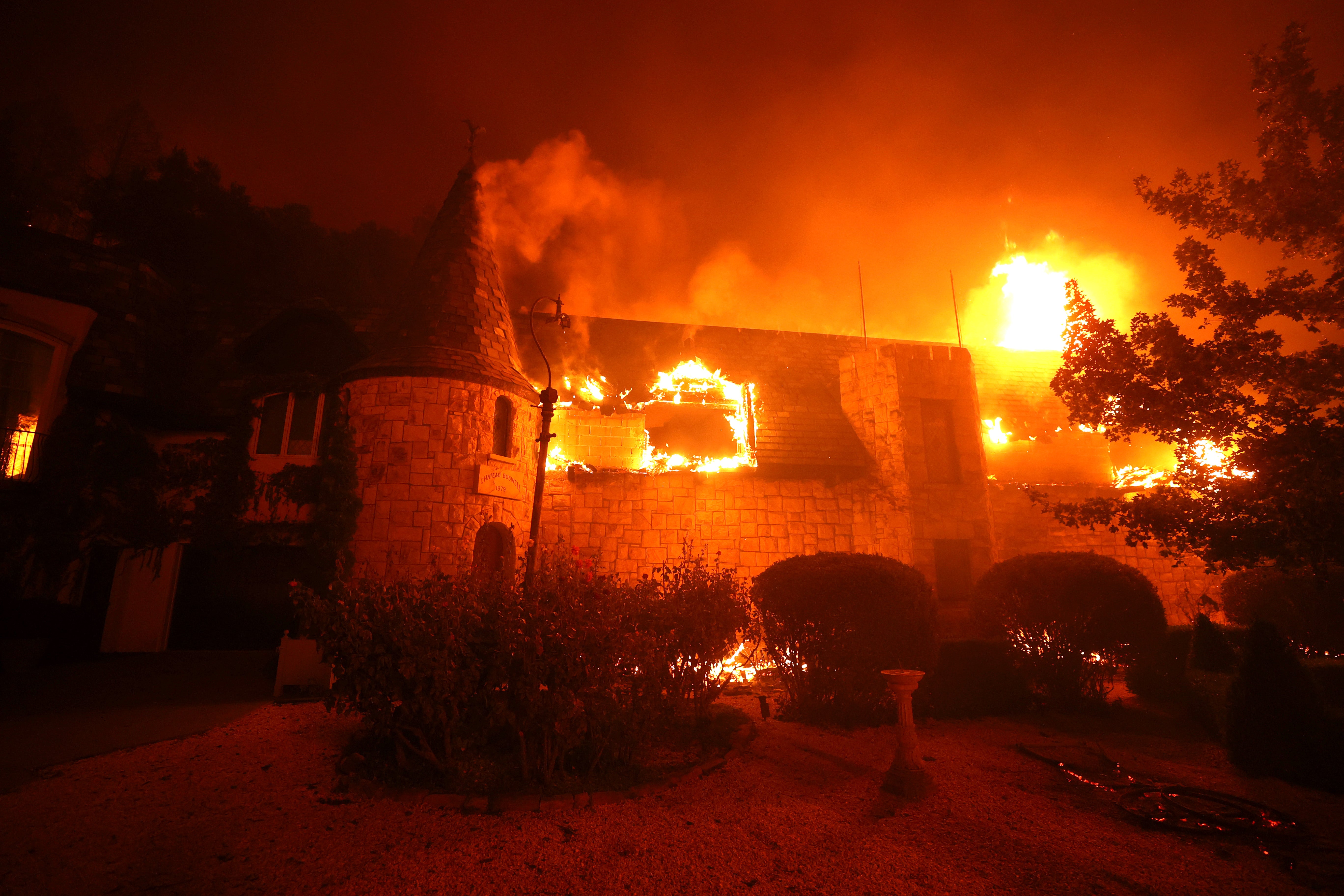
The flames ripped through the The Chateau Boswell Winery located on the Silverado Trail.
The fire also jumped Highway 29 near the Culinary Institute of America, triggering mandatory evacuation orders for residents living in the area west of Highway 29 from Deer Park Road to Elmhurst and all of Spring Mountain Road.
That evacuation area was expanded at 11:44 p.m. to west of Highway 29 from Deer Park Road to Bothe Park Road west to the county line. Additionally, an evacuation warning was in place for the area west of Highway 29 from Booth State Park to Diamond Mountain Road west to the county line.
Shortly after 11 p.m. an earlier evacuation warning for Howell Mountain Road to the dead end of Conn Valley and all of Rossi Road and Greenfield Road was upgraded to a mandatory evacuation order.
Two other wildfires erupted in the area Sunday night. The Boysen Fire was burning off Spring Mountain Road just west of St Helena while the Shady Fire was burning toward the west near Santa Rosa.
A growing evacuation order area extends from St. Helena Road -- where the two new fires sparked Sunday evening -- all the way to Highway 12.
Santa Rosa Police have issued evacuation orders for the areas of Calistoga North, Calistoga South/Skyhawk, Oakmont North, Oakmont South, Melita, Stonebridge and Pythian. Residents were told to leave the area immediately and head south.
Evacuation warnings were issued for the areas of Summerfield, Spring Lake, Northeast 2 and Northeast/Middle Rincon shortly before midnight.
There were reports that city buses were being used to evacuate seniors from Oakmont Village, a retirement community near Santa Rosa as well as other assisted-living centers in the area.
More detailed information on the evacuation orders can be found on the Santa Rosa Police nixel alert page.
Two temporary evacuation points were operational in Santa Rosa at A Place to Play on 2375 West 3rd Street and at the Santa Rosa Veterans Building at 1351 Maple Avenue. Another temporary evacuation point was set up at the Petaluma Veterans Hall.
There were reports that the Boysen Fire and the Shady Fire were close to merging after 11 p.m.
The Sonoma County Sheriff tweeted just after midnight that residents evacuating from the Boysen and Shady Fires should head east on Highway 12 towards Sonoma as traffic traveling west towards Santa Rosa was gridlocked.
On Sunday afternoon, air tankers -- including DC-10s and a 747 -- waged a fierce battle with the flames as the fire took a run in Bell Canyon and toward the Bell Hill Reservoir.
Due to the topography - steep terrain with minimal access - there was no way to fight the fire from the ground. It has to be from air.
Officials have issued mandatory evacuation orders for the following areas:
- Residents living in the community of Deer Park, an area of Silverado Trail cross of Larkmead Ln through Deer Park Rd and all of Crystal Springs Rd and North Fork Crystal Springs Rd.
- Residents living on College Avenue at Howell Mountain Road to White Cottage Road and all of Freisen Drive, including all roads west of College Avenue and Freisen Drive, and all of Lommel Road.
- Residents on Silverado Trail from Lommel Road to Pickett Road.
- Residents on the eastside of Silverado Trail from Deer Park Road to Meadowood Road, including the entirety of all roads in between. The order included the Meadowood Resort.
- Residents on the eastside of Silverado Trail from Deer Park Road south to Howell Mountain Road (aka Old Howell Mountain Road)
- Residents on Howell Mountain Road up to Deer Park Road to include all roads off of Howell Mountain Road
- All residences on Conn Valley Road
- Residents in the unincorporated area from the 2900 block of White Sulpher Springs Road (St. Helena City Limits) to the dead end and north to Spring Mountain Road.
- Residents from 1650 South Whitehall Lane north to White Sulpher Springs Road and west to the County line.
- Residents within the city of St. Helena from Elmhurst Avenue to Madrona Ave west of Highway 29 to the St. Helena city limits.
In Sonoma County
- Zone 6A1:
- Southwest of Highway 12
- East of Santa Rosa City Limits, the eastern boundary of Annadel State Park, and Savannah Trail
- North of Bennett Valley Road
- West of Warm Springs Road
- Zone 6B1:
- South and west of the Napa/Sonoma County Line
- Northeast of Highway 12 and north of the southernmost boundary of Sugarloaf Ridge State Park
- Northwest of Adobe Canyon Road
- East of Pythian Road and Hood Mountain Regional Park
- Zone 6B2:
- Northeast of Highway 12
- Northwest of Nelligan Road/Nuns Canyon Road
- West of the Napa/Sonoma County line
- Southeast of Adobe Canyon Road and south of Sugarloaf Ridge State Park
- Zone 3G1:
- South of St. Helena Road
- West of the Napa/Sonoma County line
- North of Los Alamos / Cleland Ranch Roads
- East of Calistoga Road
- Residents in areas west of Highway 29 from Deer Park Road to Elmhurst, and all of Spring Mountain Road.
- Zone 3G2:
- South of Cleland Ranch Road
- West of Los Alamos Road
- North and east of Santa Rosa County limits
- East of Calistoga Roads
- Zone 3G3:
- South of Alamos Road
- West of Santa Rosa City Limits and Los Alamos Road
- Northeast of Highway 12
- West of Napa/Sonoma County Line, the easternmost boundary of Hood Mountain Regional Park, and easternmost boundary of Los Guilicos Juvenile Center. This INCLUDES Los Guilicos Juvenile Center.
- Zone 2P1:
- South of Porter Creek Road
- East of Mark West Springs Road
- North of Santa Rosa City Limits
- West of Calistoga Road
After waking up to fire alerts and messages from worried friends, Amy Bordeau of Calistoga said she grabbed the same bag she recently used when evacuating from another nearby wildfire.
"It's a bit traumatizing," she said. "I feel like I'm constantly fight or flight."
Deputy Matt Macomber, one of several deputies currently evacuating parts of Napa County, posted a frightening video on social media of driving down a fire-surrounded lane in the hills.
Napa County officials have set up evacuation center at Crosswalk Community Church, 2590 First Street in Napa. The sheriff's department asked the evacuated residents to clear out of the area.
"When evacuating, please leave the area," deputies posted. "Do not stop/park in turnouts to view the fire. First responders often need access to the turnouts to park emergency vehicles."
Contra Costa County fire emergency response crews were also dispatched Sunday morning to help with the evacuation of Adventist Health St. Helena hospital. Hospital officials told KPIX they were "safely evacuating patients to nearby hospitals."
Over just a few hours since the blaze was first reported at 3:50 a.m., the fire had grown to more than 1,200 acres with zero containment. The fire was being fueled by tinder-dry vegetation on the rural hillsides after weeks of high temperatures and low humidity.
Videos posted on social media showed structures ablaze. Getty Images photographer Justin Sullivan posted video of one of those structures burning.
Other videos were also posted on Twitter.
The area, located between St. Helena and Calistoga off North Silverado Rd., is home to dozens of wineries. Among those threatened by flames was Reverie Winery, Viader Winery and Davis Estates winery.
"We found out this morning at 4:45 that the fire started at the 200 block of Crystal Springs and, considering our address is 264 it was a pretty scary moment, for sure," Reverie owner Grant Long told KPIX 5.
Long made the spooky drive to his winery Sunday afternoon, wondering if it would still be there. The neighbor's house across the street is gone, but thanks to the vineyards and a lot of defensible space, the winery lives on.
"It was very surreal for a moment because it's almost like it wasn't here and you have to see it to believe it and being able to pull up and see it," he said. "It's a blessing."
Cal Fire said its crews were fighting a "vegetation fire with dangerous rate of spread." Meanwhile, PG&E said it "turned off power for about 3,000 customers between approximately 4:30 a.m. and 6:15 a.m. Sunday morning in Napa County as a precaution.
RELATED: IMAGES: Raging Glass Fire Leaves Path Of Destruction Through Wine County
Air support from tankers and helicopters began making water and fire retardant drops after 8 a.m. Fire crews that have been battling the nearby LNU Lightning Complex fire for more than a month were being hurried to the area.
Angwin Fire officials told their local residents to get prepared if they need to evacuate -- "Angwin is under advisory evacuation. Please consider safely departing off the mountain."
The fire was not related to the LNU Lightning Complex fire which has burned 363,200 acres in Napa, Sonoma and Solano counties and was 98 percent contained as of Saturday evening.
Satellite images released by the National Weather Service showed the fire was growing in intensity.
The area was under a red flag fire warning for weather conditions that include gusty winds, low humidity and warm early morning temperatures.
"Currently, wind gusts of between 30 and 40 mph are being observed above 1500 feet in the North and East Bay, and Mount Saint Helena (elev. 4300 feet) has been reporting gusts as high as 65 mph early this morning," the National Weather Service said early Sunday.