Caldor Fire Update: Massive Wildfire Explodes to 30,000 Acres; Newsom Declares State of Emergency
GRIZZLY FLATS, El Dorado County (CBS SF) -- New evacuations were ordered in El Dorado County ahead of the Caldor Fire that exploded to approximately 30,000 acres in the Sierra Nevada Tuesday after Gov. Gavin Newsom declared a state of emergency in the county.
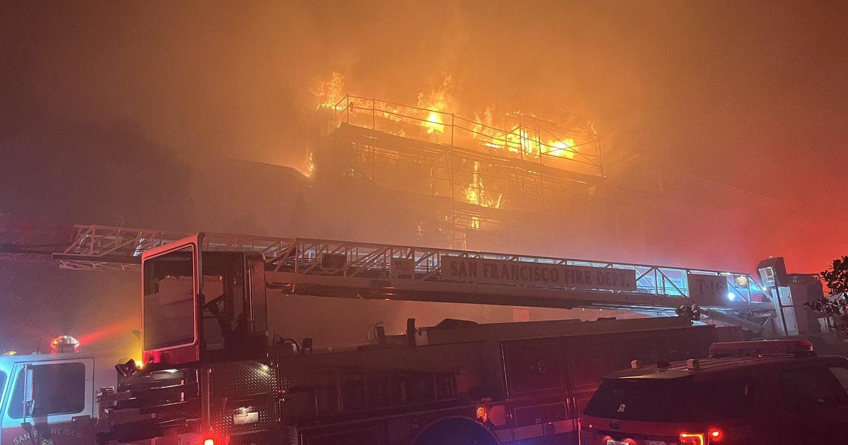
The fire has already destroyed dozens of homes and is threatening hundreds of more structures, fire officials said.
At 8:45 p.m. new mandatory evacuations orders were issued by the El Dorado County Sheriff for all areas between Mormon Emigrant Trail and Hwy 88 Citizen. At 8 p.m., orders were issued for the following areas:
- Intersection of Perry Creek and Hawk Haven
- East side of Fairplay Road from Perry Creek South to Cedarville Road
This includes Slug Gulch, Omo Ranch, and all roads off of Slug Gulch & Omo Ranch - All roads off of Omo Ranch from Cedarville Road to Hwy 88
Authorities said the evacuation centers at Diamond Springs Fire Hall
(located at 3734 China Garden in Diamond Springs) and the Cameron Park Community Services District (located at 2502 Country Club Drive in Cameron Park) were full as of 9:45 p.m., but the center at the Green Valley Church (at 3500 Missouri Flat Road in Placerville) was still accepting evacuees.
Earlier at 6:30 p.m., mandatory evacuations orders were issued by the El Dorado County Sheriff for the following areas:
- South side of Hwy 50 North of Sly Park to extend West to Snows Road
- North side of Hwy 50 from Larsen Drive to the west and Ice House to the East
Portions of Pollock Pines, a community well known to Bay Area travelers headed to the Lake Tahoe area along U.S. Highway 50, were being evacuated Tuesday afternoon ahead of the wildfire.
CHP was warning that Highway 50 may have to be closed due to the fire.
As of Cal Fire's Tuesday evening update, the fire has consumed approximately 30,000 acres with zero containment after igniting over the weekend in the Cosumnes River Canyon area of the El Dorado National Forest.
The fire was only estimated at about 6,500 acres Tuesday morning.
Access to the fire is extremely difficult because of the steep, rugged terrain, according to the U.S. Forest Service.
A Cal Fire battalion chief said at least 50 homes were burned in the Grizzly Flats area as gusty winds have been pushing embers into homes that had defensive space.
Cal Fire also confirmed that two civilians were found who had suffered serious injuries in the fire.
One of the fire victims reportedly approached firefighters in the Grizzly Flats area Tuesday morning. Those firefighters provided initial medical treatment, but the fire victim was then transported via air ambulance to a hospital for treatment of serious injuries.
The second person was also found in the Grizzly Flats area and was also transported via air ambulance for treatment at a hospital. Authorities did not provide any additional information about the fire victims beyond that they were seriously injured and required airlifting.
On Tuesday afternoon, Governor Gavin Newsom declared a state of emergency for El Dorado County due to the Caldor Fire.
Raw Video: Aftermath of Caldor Fire in Grizzly Flats
The actual number of destroyed and damaged structures was unknown as of 1:35 p.m. as fire conditions were not yet safe to bring in assessment teams. Fire officials said the Caldor Fire is a rapidly changing incident with dynamic fire behavior and poses a high risk to multiple populated communities.
The El Dorado County Sheriff has ordered the following evacuations:
Pollock Pines
- East of Sly Park Road. South of Hwy 50 up to Ice House Road. North of Mormon Emigrant Trail (including Jenkinson's/Sly Park Lake).
Grizzly Flats/Somerset
- All roads off of Grizzly Flat Rd., east of Mt. Aukum Rd. in Somerset(Known as Four Corners) into Grizzly Flats Proper
Happy Valley
- All roads off of Happy Valley Road, east of Mt. Aukum Rd. in Somerset to Sciaroni
- Leoni Meadows
- Saw Town Creek
- Caldor area including North South Road
- Dogtown Creek South of Caldor Road
- Barney Ridge East of Omo Ranch Road
- Omo Ranch Road to North South Road
- Caldor area including North South Road
- Pi'Pi Valley up to Armstrong Hill
Evacuation warnings were issued for the following areas:
- South of Hwy 50 to Pleasant Valley Road. From Sly Park Road, west to Snows Road and Newtown Road, including the community of Rancho Del Sol.
- Communities of Omo Ranch Proper, Omo Ranch East, and Omo Ranch South.
- All roads off of Grizzly Flat Rd., east of Mt. Aukum Rd. in Somerset (Four Corners) into Grizzly Flats proper
- All roads off of Happy Valley Road, east of Mt. Aukum Rd. in Somerset to Sciaroni
- Leoni Meadows
- Saw Town Creek
- Caldor area including North South Road
- Dogtown Creek South of Caldor Road
- Barney Ridge East of Omo Ranch Road
- Omo Ranch Road to North South Road
- Caldor area including North South Road
- Pi'Pi Valley up to Armstrong Hill
Cal Fire said Tuesday morning that at least 800 structures are currently threatened, including residences and outbuildings. There are also threats to businesses, commercial timberlands, vineyards and other agricultural lands.
Fire crews have been working on constructing indirect control lines of the eastern flank of the fire while a contingency line construction was planned for north of the fire, according to the forest service. Fire officials said crews have been challenged by staffing shortages and other fire incidents in the state.
A Red Flag Warning was in effect in the area until 8 a.m. Wednesday. Hot and dry weather was expected to continue over the fire early this week and winds were expected to continue to increase throughout the week.
A Pacific Gas and Electric power outage map showed more than 1,100 customers in the area were without power Tuesday afternoon.
CALDOR FIRE: Incident Information, Evacuations, Maps
The wildfire began Saturday evening about four miles south of Grizzly Flats and about two miles east of Omo Ranch. The cause of the fire was still under investigation.
A local evacuee, Will Berndt, said the fire began in an area where a group had been camping along Dogtown Creek. Another witness told Berndt two people with singed clothing were seen leaving the site, alerting others that a fire was burning and to leave the area.
"It wasn't a big fire, so I thought maybe they were gonna get someone to respond to it," Berndt said. "Nothing happened."
Berndt said Sunday morning at about 9 a.m. he returned to the area to take a look and the fire had spread across the Middle Fork Consumnes River toward Omo Ranch, running up the side of the canyon. By 11:30 a.m. Berndt said fire crews were using air tankers to fight the fire.
Berndt said in the decades he's lived in the area he never had to evacuate from a wildfire.
"We have talked about it, we've been up here for 43 years and we had talked about, so, what if the mountain burns, what are we gonna do?" said Berndt. "It's like, well, you just grab what you can and get out of here. It's one of those thoughts that, you see it on TV, you see other communities have to deal with it, and you go, 'Well, that sucks.' But you never think that, you know, we're gonna be in the path of a stinking firestorm."
ALSO READ: Dixie Fire Update: New Mandatory Evacuation Orders Issued in Lassen County
An evacuation center was open at The Fireman's Hall at 3734 China Garden Road in Diamond Springs. People with small animal shelter needs can contact the El Dorado County Animal Services at (530) 621-5795. Large animals were being sheltered at the Amador County Fairgrounds, 18621 Sherwood St., Plymouth.