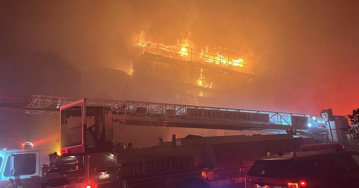
'Knocking on Door to Lake Tahoe Basin;' Caldor Fire Eclipses 114,000 Acres; Nation's Top Firefighting Priority
EL DORADO NATIONAL FOREST (CBS SF) -- The Caldor Fire burning in the Sierra Nevada has become the top firefighting priority in the nation and the Cal Fire chief Monday afternoon acknowledged the possible threat to the Lake Tahoe area.
The wildfire has burned 114,166 acres, or nearly 178 square miles, in the El Dorado National Forest since it began on August 14 East of Omo Ranch and south of the community of Grizzly Flats. Containment was reported at nine percent as of Monday night.
Cal Fire Thom Porter told reporters at a Monday press conference the Caldor Fire is getting top priority in the allocation of firefighting resources because of its proximity to Tahoe.
"It is that important," he said. "It is knocking on the door to the Lake Tahoe basin. We have all efforts in place to keep it out of the basin, but we do also need to be aware that that is a possibility based on the way the fires have been burning."
Chief Clive Savacool with the South Lake Tahoe Fire Department said crews were working with Tahoe officials to come up with backup plans, just in case the flames move further east.
"The evacuation warnings aren't into the Tahoe Basin yet, they are not into South Lake Tahoe, we don't want to have anybody panic, we just want to be able to keep up to date with constant information, accurate information from reliable sources," said Chief Savacool.
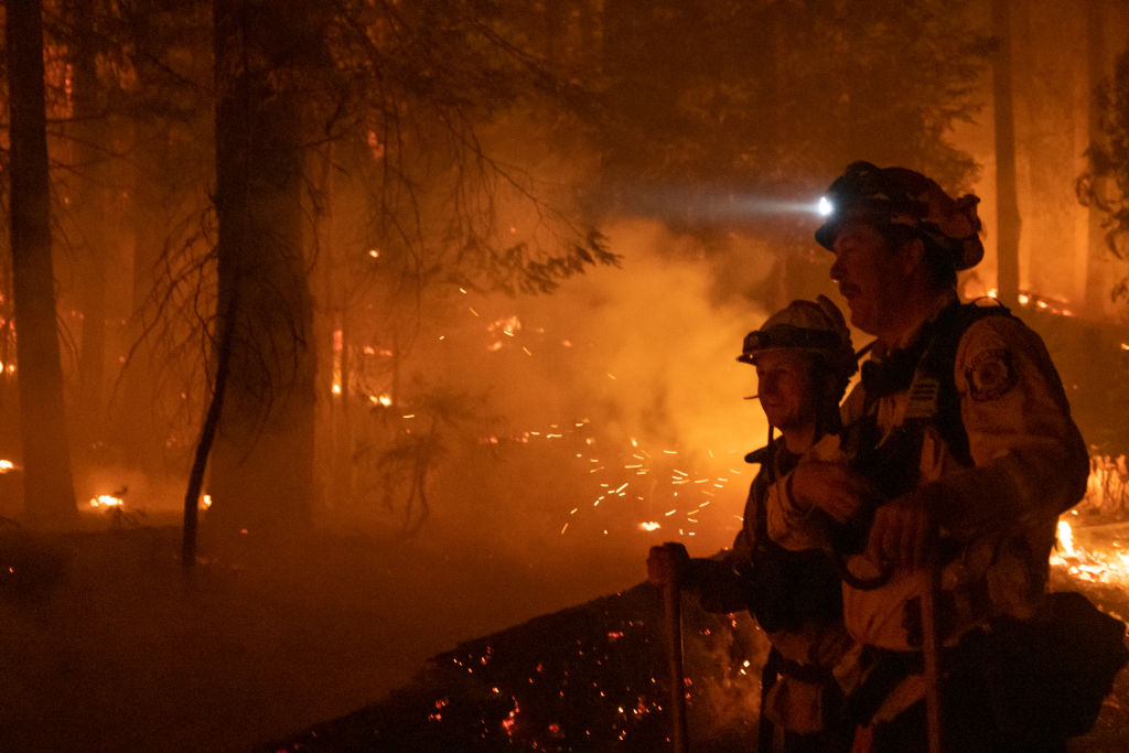
After a week of zero containment, fire officials reported five percent containment Monday and more containment is expected especially along the southern edge of the fire throughout the day.
At a California Governor's Office of Emergency Services news conference Monday afternoon, officials announced that two Galt police officers were severely hurt in a head-on collision early Sunday morning along Highway 99 as they headed to help in Caldor Fire. Two other civilians were injured in the fire last week.
As of Monday night, at least 500 homes have been destroyed in the fire, and more than 17,000 homes and other structures are threatened. Six commercial properties have been destroyed along 148 other minor structures, Cal Fire said. The cause has not yet been determined.
Overnight downslope winds, low temperatures, and moderate humidity levels have helped slow the fire's spread.
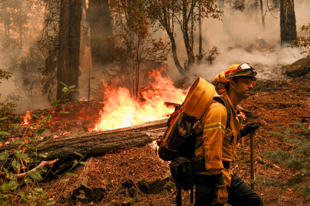
Operations Section Chief Tim Ernst said Monday the most challenging area of the fire continues to be around the point of origin with flames continuing to make runs up toward Grizzly Flats, which saw dozens of homes burned in the wildfire last week.
"To address that problem, we're putting in a lot of contingency lines and dozer lines, and last night we ran a long firing operation to take some of the fuel away from the fire," said Ernst. "But the fire continues to challenge us in this area."
After jumping U.S. Highway 50 on over the weekend, Ernst said there no extensive fire growth past Highway 50 overnight and crews were engaged in extensive structure defense and preparation on the northern edge of the fire.
There is no word on when the 50-mile stretch of Highway 50 will open. It remains closed from Pollock Pines to Meyers because of thick smoke, ash and the threat of falling trees.
Air quality was also a major concern around Tahoe. Many residents have already left the area because the smoke was so bad.
On the western perimeter, a significant amount of work was done around Jenkinson Reservoir and the Sly Park area to tie together existing fire lines, Ernst said. The eastern tip of the fire continues to be a challenge because of winds from the southwest every day pushing the fire in an eastern direction.
It was expected more of the southern perimeter would be contained later Monday.
Melissa Gustafson was among the area residents who have been forced to flee her home. She and her family of seven had to leave their room at the Best Western in Placerville this weekend and head to stay with relatives in the San Francisco Bay Area.
Her bill was for several hundred dollars and was paid for by a Good Samaritan.
"A lady behind me (in the checkout line) was (with) Cal Fire and told me she would take care of my bill for me," said Gustafson, fighting back tears. "I was just so happy! We don't have anything. What do you do when you have nothing?"
CALDOR FIRE: Incident Information, Evacuations, Maps
Current mandatory evacuations include:
- Grizzly Flats: The areas on Grizzly Flats Road east of Kendra Way into Grizzly Flats Proper. The areas of Diamond Railroad Grade, Old School House, Sweeney Road, Caldor Road, and steely Ridge.
- Grizzly Flats Road east of four corners in somerset into Grizzly Flats Proper.
- The areas of Myers Lane, Varmet Ridge Road, Rodwell Canyon Road, Snowbird Lane, and Mehwald Lane.
- East of Sly Park Road between Highway 50 and Mormon Emigrant Trail to Ice House Road. This includes the communities of Pacific House and Fresh Pond.
- North of Highway 50, east of Forebay Road to Ice House Road.
- Intersection of Perry Creek and Hawk Haven, the East side of Fairplay Road from Perry Creek South to Cedarville Road. This includes Slug Gulch, Omo Ranch, and all roads off of Slug Gulch and Omo Ranch.
- All roads off of Omo Ranch from Cedarville Road to Hwy 88.
- The area between Highway 88 and Mormon Emigrant Trail
- South of Highway 50 from Snows Road to Ice House Road.
- Between Highway 50 and Slab Creek from Snows Road to Ice House Road.
- South of Highway 50 from Ice House Road to Silver Fork Road. This includes the community of Kyburz.
- North of Highway 50 from Ice House Road to Silver Fork Road to include Ice House Reservoir, Union Valley Reservoir, and Loon Lake.
- Silver Fork Road in Kyburz east to Twin Bridges.
- North and south in a line extending from Twin Bridges to the Placer County line and south to the Amador County line.
- Areas south of Farnham Ridge Road and east of Bridgeport School Road to the Amador County line.
Evacuations warnings for El Dorado County and Amador County along with road closures can be found here.
The Caldor Fire along with other Northern California wildfires have prompted the USDA Forest Service Pacific Southwest Region to temporarily close nine National Forests. Beginning Sunday, Aug. 21, these parks and the roads and trails inside them will be off limits to visitors until Sept. 6.