Magnitude 3.7 Quake Strikes South Of Hollister On Loma Prieta Anniversary
HOLLISTER (CBS SF) -- A magnitude 3.7 earthquake struck San Benito County Thursday morning, as the region marks 30 years since the devastating Loma Prieta Earthquake.
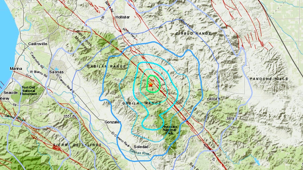
According to the U.S. Geological Survey, the earthquake struck at 7:54 a.m. along the San Andreas Fault about 16 miles southeast of Hollister and about 10 miles northwest of Pinnacles National Park.
There are no immediate reports of damage or injuries.
Thursday's earthquake follows significant earthquakes that have struck the region in recent days, including a magnitude 4.7 that struck nearby in Tres Pinos on Tuesday, and a magnitude 4.5 earthquake that struck in Pleasant Hill on Monday night.
One of the worst natural disasters to ever strike the Bay Area, the Loma Prieta earthquake that struck at 5:04 p.m. on October 17, 1989 killed 63 people, injured nearly 4,000 others and caused widespread damage.
COMPLETE QUAKE COVERAGE: CBS San Francisco Earthquake Resource Center
This article will be updated as information warrants, and follow KPIX 5 on Twitter at @KPIXtv for updates on breaking news anytime.
DID YOU FEEL IT?: USGS Shake Map For Northern California
LIVE QUAKE MAP: Track Real-Time Hot Spots
BAY AREA FAULTS: Interactive Map Of Local Faults
Strong earthquakes with an epicenter off the coast can trigger tsunamis, depending on the size and type of the fault movement. The Pacific Tsunami Warning Center tracks earthquake data for the West Coast.
WEST COAST TSUNAMI TRACKING:
Tsunami Alerts & Maps


