Bay Area To Be Battered By Atmospheric River; Incoming Storms Prompts Warnings, Evacuations
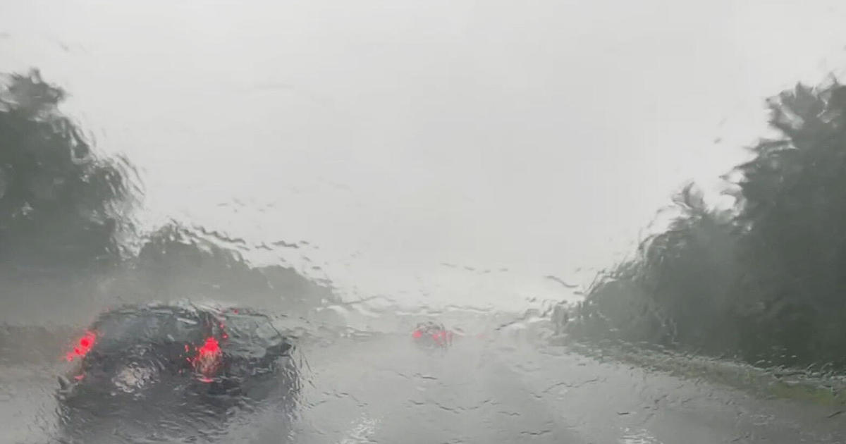
SAN FRANCISCO (CBS SF) -- Bay Area residents were bracing for an atmospheric river-fueled series of storms which have prompted a number of watches and warnings across the region, especially for areas scarred by wildfires - including in the Santa Cruz Mountains where some evacuations have been ordered.
The National Weather Service issued a Flash Flood Watch for the coastal North Bay, North Bay interior valleys, North Bay mountains, the San Francisco Peninsula coast, Santa Cruz Mountains, Santa Lucia Mountains, and the Los Padres National Forest.
The flood watch was set to be in effect from Tuesday afternoon through Thursday afternoon.
According to the weather service, the storms will bring prolonged periods of moderate to heavy rain along with gusty winds, with the brunt of the storm forecast to occur between Tuesday evening through Wednesday.
As much as 10 inches of rain is expected in the Santa Cruz Mountains and as much as 13 inches in the Santa Lucia Mountains, with even higher amounts possible on southwest-facing slopes in the coastal ranges like Big Sur, the weather service said.
There was "high confidence" that thresholds for debris flow will be met in the burn scar areas of Meyers, Walbridge, Glass, Hennessey, Woodward CZU Lightning Complex, Carmel/River, and Dolan, according to the weather service.
On Monday, Cal Fire issued evacuation orders for residents in the Santa Cruz Mountain burn area of last fall's devastating CZU Lightning Complex fire ahead of the storm's arrival.
People living in burn scar areas were urged to sign up for their county's alert system and have a "go bag" ready in case of evacuations.
Sonoma County officials issued a warning in connection with the flash flood watch issued by the National Weather Service for the region between Tuesday at 4 p.m. and Thursday at 4 p.m.
Due to heavy forecast rains within burn scar areas, landslide and debris flows are a potential threat to those living in these areas or traveling on adjacent roads, the warning said.
"The County reminds residents to be aware of changes in the environmental landscape in their area," the issued release read. "Changes caused by fire, wind or rain may affect storm-water drainage on slopes resulting in land movement, flows and slides."
The Glass Fire east of Santa Rose left the steep hillside burned to bare earth in many places, raising the chances for a mudslide or debris flow.
It is a real concern, Sonoma Valley Fire Battalion Chief Spencer Andreis told KPIX 5.
"This is all different areas in the county that are impacted with the fires," said Andreis. "So we're going to be maintaining a heightened awareness and closely monitor the situation."
Along St. Helena Road, there is still heavy fire damage visible. Many homes were lost, but one house survived. Owners Jim and Betty Doerksen are worried about the coming storm.
"From the top of that mountain over there, it's all burned, right? And that's my neighbor's property. There was already erosion over there, lots of erosion," said Jim Doerksen. "Now with all those tree gone, the canopy gone, I can see a small catastrophe."
Sonoma Fire Department is optimistic about the preparedness of the county. They said teams have been preparing for months for this winter. If the situation remains as a watch instead of a warning, they might not see the big debris flows at all. They are ready for the worst, just in case.
"With high winds and the amount of rain we're going to get, there's potential for trees bringing power lines down and unsafe roads," said Andreis. "If you can stay in, by all means please do so."
The county additionally issued a freeze warning due to forecast overnight lows Tuesday morning as well as a high-wind watch from Tuesday evening at 7 p.m. until 10 a.m. Wednesday morning.
Officials recommend that residents limit time outdoors due to cold temperatures.
For non-burn scar areas, there could be rapid ponding of water in urban areas and low-lying areas with poor drainage.
Monday there was light to moderate precipitation and scattered showers forecast before the atmospheric river's arrival Tuesday. Temperatures across the Bay Area will be cool with daytime highs in the 50s and lows at night in the 20s and 30s.
KPIX 5 Weather Center: Current Conditions, Maps, Forecasts For Your Area
Gusty winds remained along the coast with temperatures in the 40s. The High Wind Watches that were already in place were upgraded to High Wind Warnings and Advisories from Tuesday night through Wednesday afternoon for San Francisco, Coastal North Bay, an Francisco Peninsula Coast the Santa Cruz Mountains and the northern part of Monterey Bay.
Meanwhile, a Gale Warning was in effect through 3 a.m. Tuesday from Point Reyes to Pigeon Point, with northwest winds 25 to 35 knots with gusts up to 45 knots and seas 13 to 17 feet at 14 seconds.
ALSO READ: Sierra Prepares To Be Buried Under Several Feet Of Snow From Atmospheric River
Mariners were urged to alter their plans to avoid these hazardous conditions. Remain in port, seek safe harbor, alter course, and/or secure the vessel for severe conditions.
Don Ford contributed to this story.